


For 7000 ft. to 8000 ft.
| Monday | Monday Night | Tuesday | |
|---|---|---|---|
| Weather: | Mostly cloudy skies with scattered rain showers. A slight chance of thunderstorms in the afternoon. | Mostly cloudy skies, becoming partly cloudy. Scattered rain showers with a slight chance of thunderstorms in the evening. | Partly cloudy skies, becoming mostly cloudy. |
| Temperatures: | 43 to 50 deg. F. | 27 to 34 deg. F. | 44 to 51 deg. F. |
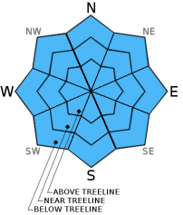
| Mid Slope Winds: | SW | W | SW |
| Wind Speed: | Light winds increasing to 10 to 15 mph in the afternoon. | 10 to 15 mph in the evening, becoming light. | 15 to 20 mph. Gusts up to 30 mph in the afternoon. |
| Expected snowfall: | 0 | 0 | 0 |
For 8000 ft. to 9000 ft.
| Monday | Monday Night | Tuesday | |
|---|---|---|---|
| Weather: | Mostly cloudy skies with scattered rain and snow showers. Snow level 8,500' to 9,500'. A slight chance of thunderstorms in the afternoon. | Mostly cloudy skies, becoming partly cloudy. Scattered rain showers with a slight chance of thunderstorms in the evening. | Partly cloudy skies, becoming mostly cloudy. |
| Temperatures: | 39 to 46 deg. F. | 27 to 34 deg. F. | 40 to 47 deg. F. |
| Ridge Top Winds: | SW | W | SW |
| Wind Speed: | Light winds, increasing to 10 to 15 mph in the afternoon. | 10 to 15 mph in the evening, becoming light. | 10 to 15 mph with gusts to 25 mph, increasing to 20 to 25 mph with gusts to 35 mph in the afternoon. |
| Expected snowfall: | 0 | 0 | 0 |


