


For 7000 ft. to 8000 ft.
| Wednesday | Wednesday Night | Thursday | |
|---|---|---|---|
| Weather: | Partly cloudy skies, becoming mostly cloudy. A slight chance of snow in the afternoon. | Cloudy skies with snow likely in the evening. Snow after midnight. | Cloudy skies with snow through the day. Snow changing to rain in the afternoon. |
| Temperatures: | 27 to 32 deg. F. | 23 to 28 deg. F. | 37 to 42 deg. F. |
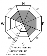
| Mid Slope Winds: | S | SW | SW |
| Wind Speed: | Light winds | 10 to 15 mph with gusts to 25 mph. | 10 to 15 mph with gusts to 25 mph, increasing to 25 to 35 mph with gusts to 45 mph in the afternoon. |
| Expected snowfall: | 0 to trace | 2 to 4 | 2 to 6 |
For 8000 ft. to 9000 ft.
| Wednesday | Wednesday Night | Thursday | |
|---|---|---|---|
| Weather: | Partly cloudy skies, becoming mostly cloudy. A slight chance of snow in the afternoon. | Cloudy skies with snow likely in the evening. Snow after midnight. | Cloudy skies with snow. |
| Temperatures: | 25 to 30 deg. F. | 22 to 27 deg. F. | 34 to 40 deg. F. |
| Ridge Top Winds: | S | SW | SW |
| Wind Speed: | 10 to 15 mph with gusts to 35 mph. | 20 to 30 mph with gusts to 75 mph. | 35 to 55 mph with gusts to 90 mph. |
| Expected snowfall: | 0 to trace | 2 to 4 | 3 to 6 |


