THIS AVALANCHE FORECAST EXPIRED ON January 27, 2016 @ 6:58 am
Avalanche Forecast published on January 26, 2016 @ 6:58 am
Issued by Steve Reynaud - Tahoe National Forest

Avalanche danger is low on all aspects and elevations.  Watch for unstable snow on isolated terrain features.  Normal caution is advised.  Small isolated wind slabs could form on SE-S-SW-W-NW aspects above treeline.  Very isolated deep slab avalanches are unlikely but not impossible on N-NE-E aspects near treeline and below treeline.

1. Low

?

Above Treeline
Generally safe avalanche conditions. Watch for unstable snow on isolated terrain features.

1. Low

?

Near Treeline
Generally safe avalanche conditions. Watch for unstable snow on isolated terrain features.

1. Low

?

Below Treeline
Generally safe avalanche conditions. Watch for unstable snow on isolated terrain features.
    Generally safe avalanche conditions. Watch for unstable snow on isolated terrain features.
Avalanche Problem 1: Wind Slab
  • Type ?
  • Aspect/Elevation ?
  • Likelihood ?
    Certain
    Very Likely
    Likely
    Possible
    Unlikely
  • Size ?
    Historic
    Very Large
    Large
    Small

NE winds increased in speed late last night and into this morning in the moderate to strong range.  Wind slabs could form on SE-S-SW-W-NW aspects above treeline.  These wind slabs are expected to be small in size and limited to exposed higher peaks and ridgelines.  The NE winds are forecasted to decrease in speed and switch direction to the S by midday.  If the NE winds further increase in speed or last longer than forecasted, these wind slabs could become more reactive and larger than expected.

Look for visible blowing snow, cornice formation, wind pillows, and snow surface scouring as clues to identify suspect slopes.  

Avalanche Problem 2: Deep Slab
  • Type ?
  • Aspect/Elevation ?
  • Likelihood ?
    Certain
    Very Likely
    Likely
    Possible
    Unlikely
  • Size ?
    Historic
    Very Large
    Large
    Small

Buried surface hoar that is 1.5 to 4.5 feet deep in the snowpack in some areas has become unlikely as a deep persistent slab avalanche problem.  A widespread persistent slab avalanche cycle occurred Jan 5 through Jan 19 on these weak layers.  Many slopes have been cleaned out by already avalanching, or the surface hoar has been collapsed or compressed and has started to gain strength.  No avalanche activity has been associated with these buried surface hoar layers over the past week.

Although this avalanche problem is unlikely, the consequences associated with a deep persistent slab avalanche would be severe.  This problem exists on N-NE-E aspects near treeline and below treeline in open areas on slopes 32 degrees and steeper.

recent observations

Observations throughout the forecast area are showing a well bonded and consolidating snowpack.  The forecasted NE wind event for Monday morning did not materialize and little wind scouring and no wind slab development occurred.  Unconsolidated snow with good travel conditions exists on N-NE-E aspects.  Reports continued to come in of avalanche activity that occurred with the last storm cycle on Friday/Saturday that were both natural and human triggered

Observations that targeted the deep persistent slab problem on Talking Mountain (Echo Summit area) did not find any evidence of buried surface hoar.

Weather and CURRENT CONDITIONS
weather summary

High pressure will bring dry conditions and clear skies to our area today.  NE winds should switch over to the S this afternoon and be light.  Valley inversions have developed overnight with colder air trapped in the lower valleys and warmer air aloft.  Highs should reach the low 40's above 7000' today.

CONDITIONS ALONG THE SIERRA CREST BETWEEN 8200 FT. AND 9200 FT. IN THE LAST 24 HOURS
6am temperature: 22 to 30 deg. F.
Max. temperature: 26 to 32 deg. F.
Average ridgetop wind direction: NE
Average ridgetop wind speed: 20 to 30 mph
Maximum ridgetop wind gust: 52 mph
New snowfall: 0 inches
Total snow depth: 74 to 83 inches
Two-Day Mountain Weather Forecast Produced in partnership with the Reno NWS
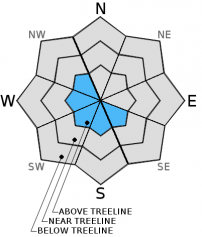
For 7000 ft. to 8000 ft.
Tuesday Tuesday Night Wednesday
Weather: Sunny then becoming partly cloudy. Partly cloudy then becoming mostly cloudy. Mostly cloudy.
Temperatures: 35 to 45 deg. F. 23 to 33 deg. F. 38 to 48 deg. F.
Mid Slope Winds: SW SW SW
Wind Speed: Light winds. Light winds becoming SW 5 to 15mph. 5 to 15mph in the morning becoming light.
Expected snowfall: 0 0 0
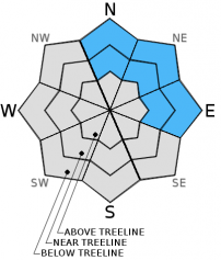
For 8000 ft. to 9000 ft.
Tuesday Tuesday Night Wednesday
Weather: Sunny Partly cloudy then becoming mostly cloudy. Mostly cloudy.
Temperatures: 32 to 42 deg. F. 21 to 31 deg. F. 34 to 44 deg. F.
Ridge Top Winds: E shifting to S in the afternoon. SW SW
Wind Speed: E 10 to 15mph with gusts to 25mph shifting to S 5 to 15mph in the afternoon. 15 to 20mph with gusts to 25mph increasing to 35mph after midnight. 15 to 20mph with gusts to 35mph.
Expected snowfall: 0 0 0
Disclaimer

This avalanche advisory is provided through a partnership between the Tahoe National Forest and the Sierra Avalanche Center. This advisory covers the Central Sierra Nevada Mountains between Yuba Pass on the north and Ebbetts Pass on the south. Click here for a map of the forecast area. This advisory applies only to backcountry areas outside established ski area boundaries. This advisory describes general avalanche conditions and local variations always occur. This advisory expires 24 hours after the posted time unless otherwise noted. The information in this advisory is provided by the USDA Forest Service who is solely responsible for its content.