THIS AVALANCHE FORECAST EXPIRED ON January 30, 2016 @ 6:59 am
Avalanche Forecast published on January 29, 2016 @ 6:59 am
Issued by Andy Anderson - Tahoe National Forest - Sierra Avalanche Center

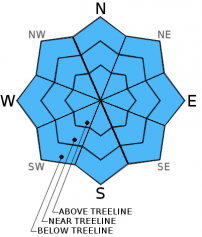
CONSIDERABLE avalanche danger exists on all aspects and elevations on slopes steeper than 35 degrees due to a combination of wet snow instabilities caused by rain on snow and newly formed wind slabs at the upper elevations. Human triggered loose wet avalanches and wind slab avalanches are likely today and some isolated wet slab avalanches may be possible. People traveling in the backcountry should make careful snowpack evaluations, use cautious route-finding and conservative decision-making, and expect to get very wet.

3. Considerable

?

Above Treeline
Dangerous avalanche conditions. Careful snowpack evaluation, cautious route-finding and conservative decision-making essential.

3. Considerable

?

Near Treeline
Dangerous avalanche conditions. Careful snowpack evaluation, cautious route-finding and conservative decision-making essential.

3. Considerable

?

Below Treeline
Dangerous avalanche conditions. Careful snowpack evaluation, cautious route-finding and conservative decision-making essential.
    Dangerous avalanche conditions. Careful snowpack evaluation, cautious route-finding and conservative decision-making essential.
Avalanche Problem 1: Loose Wet
  • Type ?
  • Aspect/Elevation ?
  • Likelihood ?
    Certain
    Very Likely
    Likely
    Possible
    Unlikely
  • Size ?
    Historic
    Very Large
    Large
    Small

Widespread rain on snow will cause wet snow instabilities to form on all aspects on slopes steeper than 35 degrees below 9600 ft. Loose wet point releases, roller balls and pinwheels should represent the majority of these wet snow instabilities and could entrain enough snow to carry a person down a slope. Terrain traps like gullies, cliffs, creeks, etc. would magnify the consequences of these loose wet avalanches and could allow for them to bury or injure a person. Human triggered loose wet avalanches are likely today and natural loose wet avalanches are possible. While loose wet avalanches will comprise the majority of wet snow instabilities, some wet slab avalanches may also be possible in isolated areas that receive the most rain. While the danger posed by these wet snow instabilities will increase as more rain impacts the forecast area today, it will quickly decrease as the snow levels drop this evening and tonight. 

Avalanche Problem 2: Wind Slab
  • Type ?
  • Aspect/Elevation ?
  • Likelihood ?
    Certain
    Very Likely
    Likely
    Possible
    Unlikely
  • Size ?
    Historic
    Very Large
    Large
    Small

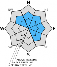
Strong winds will allow wind slabs to form on wind loaded N-NE-E and cross loaded NW and SE aspects on the upper elevation near and above treeline slopes. Since snow level should remain high today these wind slabs should remain limited to terrain above 8000 to 8500 ft. where more of the precipitation falls as snow. At these upper elevations human triggering of heavy wind slabs will become likely today and some natural wind slab avalanches may become possible. These wind slabs will become larger, more widespread, and move down in elevation as the snow levels drop this afternoon and tonight. Use clues like blowing snow, cornices above a slope, wind drifted snow, ripples in the snow, and other wind created textures to help identify where wind slabs have formed.  

Forecast discussion

What happened to the deep persistent weak layer?

In early to mid January, up to 3 separate surface hoar layers formed and were buried by subsequent storms on N-NE-E aspects near treeline and below treeline. A widespread persistent slab avalanche cycle occurred Jan 5 through Jan 19 on these weak layers.  Many slopes have been "cleaned out" by already avalanching, or the surface hoar has been collapsed or compressed and has gained strength.  Targeted observations and snowpack tests have shown that these layers, in the majority of locations, are no longer reactive and have assimilated into the snowpack.  No avalanche activity has been associated with these buried surface hoar layers since Jan. 19.

This deep persistent avalanche problem has become unlikely and has been removed as an avalanche problem.

recent observations

Yesterday observations from Tamarack Peak, Incline Lake Peak (both in the Mt. Rose backcountry), and Round Top (Carson Pass) all found a well consolidated snowpack with very few signs of instabilities. On Round Top some small skier triggered loose dry sluffs did occur and some small wind slabs had started to form near ridgelines on Tamarack Peak during the afternoon. Neither of these small instabilities represented much of a problem for backcountry travelers yesterday. 

Weather and CURRENT CONDITIONS
weather summary

A storm has brought widespread rain and strong winds to much of the forecast area. Some light rain started falling last night and precipitation has increased since 1 am. So far about .3 to .4 inches of rain has fallen along the Sierra Crest and and very little precipitation has fallen on the east side of the Lake. Snow levels hovering between 8500 and 9600 ft. have meant rain for all but the highest elevations. Precipitation and gale force west and southwest winds should continue to increase today. Expect winds that average in 60 to 70 mph range with gusts over 100 mph along the ridgelines. The forecast calls for another .75 to 1.5 inches of water to fall along the Crest with only .2 to .5 inches on the east side of the Lake. Snow levels should remain high through midday and most of this precipitation will fall as rain below 8000 ft. and a mix of snow and rain up to 9500 ft. By the end of today snow levels could fall below 7000 ft. due to a cold front associated with this storm. This cold front should push temperatures and snow levels down even farther during the night. By tomorrow morning snow levels should fall to 4000 to 5500 ft. Precipitation should continue through tomorrow and should change over to snow this evening and tonight. By tomorrow afternoon the forecast calls for a total of 1 to 3 ft of new snow above 8000 ft, 6 to 18 inches between 7000 and 8000 ft, and 3 to 6 inches below 7000 ft. Actual snow amounts will depend on how fast the snow levels drop. The snow and winds should start to decrease tomorrow. 

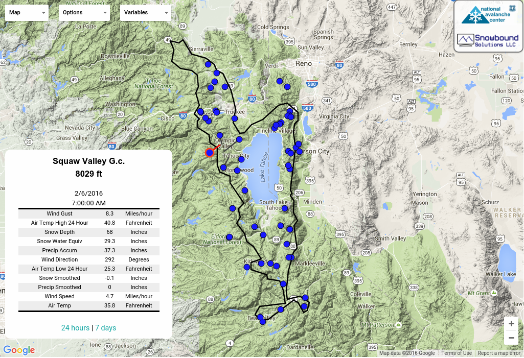
CONDITIONS ALONG THE SIERRA CREST BETWEEN 8200 FT. AND 9200 FT. IN THE LAST 24 HOURS
6am temperature: 35 to 39 deg. F.
Max. temperature: 42 to 46 deg. F.
Average ridgetop wind direction: West to southwest
Average ridgetop wind speed: 40 mph
Maximum ridgetop wind gust: 80 mph
New snowfall: Rain: .1 to .4 inches
Total snow depth: 64 to 76 inches
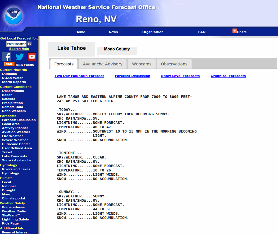
Two-Day Mountain Weather Forecast Produced in partnership with the Reno NWS
For 7000 ft. to 8000 ft.
Friday Friday Night Saturday
Weather: Rain Rain turning to snow Snow
Temperatures: 35 to 42 deg. F. 22 to 29 deg. F. 28 to 34 deg. F.
Mid Slope Winds: Southwest Southwest West
Wind Speed: 20 to 35 mph with gusts to 60 mph 15 to 30 mph with gusts to 50 mph 15 to 25 mph with gusts to 40 mph
Expected snowfall: Rain: .5 to 1.5 6 to 12 4 to 8
For 8000 ft. to 9000 ft.
Friday Friday Night Saturday
Weather: Rain and snow Snow Snow
Temperatures: 29 to 35 deg. F. 20 to 27 deg. F. 21 to 28 deg. F.
Ridge Top Winds: Southwest Southwest West
Wind Speed: 55 to 75 mph with gusts between 90 and 115 mph 60 to 70 mph with gusts to 105 mph 65 to 75 mph with gusts to 100 mph decreasing to 40 to 45 mph with gusts to 70 mph in the afternoon
Expected snowfall: 5 to 10 8 to 14 4 to 8
Disclaimer

This avalanche advisory is provided through a partnership between the Tahoe National Forest and the Sierra Avalanche Center. This advisory covers the Central Sierra Nevada Mountains between Yuba Pass on the north and Ebbetts Pass on the south. Click here for a map of the forecast area. This advisory applies only to backcountry areas outside established ski area boundaries. This advisory describes general avalanche conditions and local variations always occur. This advisory expires 24 hours after the posted time unless otherwise noted. The information in this advisory is provided by the USDA Forest Service who is solely responsible for its content.