THIS AVALANCHE FORECAST EXPIRED ON March 14, 2016 @ 7:05 am
Avalanche Forecast published on March 13, 2016 @ 7:05 am
Issued by Brandon Schwartz - Tahoe National Forest

HIGH avalanche danger is expected today near treeline and above treeline on NW-N-NE-E-SE aspects on slopes 35 degrees and steeper, especially along the Sierra Crest due to ongoing formation of wind slabs and storm slabs. For all other areas CONSIDERABLE avalanche danger exists on slopes 35 degrees and steeper. Natural and human triggered avalanches are expected today and should not be a surprise to backcountry travelers.Travel in or below avalanche terrain is not recommended. Large destructive avalanches may occur.

4. High

?

Above Treeline
Very dangerous avalanche conditions. Travel in avalanche terrain not recommended.

4. High

?

Near Treeline
Very dangerous avalanche conditions. Travel in avalanche terrain not recommended.

3. Considerable

?

Below Treeline
Dangerous avalanche conditions. Careful snowpack evaluation, cautious route-finding and conservative decision-making essential.
    Very dangerous avalanche conditions. Travel in avalanche terrain not recommended.
Avalanche Problem 1: Wind Slab
  • Type ?
  • Aspect/Elevation ?
  • Likelihood ?
    Certain
    Very Likely
    Likely
    Possible
    Unlikely
  • Size ?
    Historic
    Very Large
    Large
    Small

Strong to gale force winds out of the SW were observed to transport snow yesterday and human triggered wind slab avalanches were reported. Last nights snowfall and wind have combined to increase the size and distribution of already unstable wind slabs. Ongoing new snow accumulation and wind loading today will further increase the hazard and potential avalanche size. The vast majority of wind slabs will be found in near treeline and above treeline terrain on NW-N-NE-E-SE aspects today. Due to the strength of the winds, wind slabs may also exist below treeline on all aspects and in some areas near and above treeline on the generally windward S-SW-W aspects due to localized terrain effects changing the wind direction.

Avoid steep wind loaded areas and areas with steep potentially wind loaded slopes above as natural and human triggered avalanches are expected today. Use clues such as recent avalanche activity, blowing snow, cornice formations, wind pillows, and shooting cracks to determine where wind slab formation has occurred and identify areas to avoid.

Avalanche Problem 2: Storm Slab
  • Type ?
  • Aspect/Elevation ?
  • Likelihood ?
    Certain
    Very Likely
    Likely
    Possible
    Unlikely
  • Size ?
    Historic
    Very Large
    Large
    Small

In wind protected areas below treeline, storm slab instability is expected today. Rapid loading of new snow on top of a problematic weak graupel (pellet snow) layer as well as density changes within the storm snow created by rising snow levels today are expected to lead to snowpack instability. Shooting cracks in wind protected areas is an obvious sign of storm slab instability. Snowpit data and hand pits may be helpful in identifying the presence of buried graupel.

recent observations

Yesterday's observations made and received from the Donner Summit, Mount Rose, and Carson Pass areas indicated building wind slabs pre storm. Intentionally human triggered wind slabs were observed on Andesite Ridge (Donner Summit area) above treeline on an ENE aspect. Significant amounts of blowing snow were observed in the Mount Rose and Carson Pass areas in near treeline and above treeline terrain. A widespread layer of graupel has been observed at the base of the recent storm snow in the Donner Summit and Mount Rose areas over the past two days and likely exists in other areas as well. See below for photos, video, and more info.

Weather and CURRENT CONDITIONS
weather summary

A powerful storm system is moving through the forecast area today. As of 5:30 am this morning, new snow amounts range from 5 to 10 inches across the forecast area with accumulation ongoing. Periods of high intensity snowfall are expected today and again tonight, especially this morning and evening. Snow level is expected to rise today up to around 6,000'. Snow level may rise higher during periods of lesser precipitation intensity. Ridgetop winds are gale force this morning with gusts into 90s. Gale force SW winds are expected to continue tonight and tomorrow with ridgetop gusts reaching 100 to 120 mph. Air temperature will warm today with maximum daytime air temperatures expected to reach the low to upper 30s for areas above 7,000'. For the full details on expected snowfall totals through Monday morning, check with NWS Reno.


CONDITIONS ALONG THE SIERRA CREST BETWEEN 8200 FT. AND 9200 FT. IN THE LAST 24 HOURS
6am temperature: 25 to 29 deg. F.
Max. temperature: 27 to 32 deg. F.
Average ridgetop wind direction: SW
Average ridgetop wind speed: 53 mph
Maximum ridgetop wind gust: 96 mph
New snowfall: 5 to 10 inches
Total snow depth: 79 to 110 inches
Two-Day Mountain Weather Forecast Produced in partnership with the Reno NWS
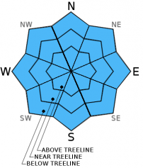
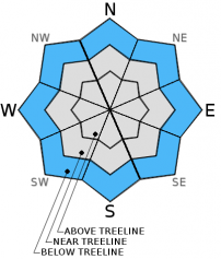
For 7000 ft. to 8000 ft.
Sunday Sunday Night Monday
Weather: Cloudy skies with snow. Cloudy skies with snow. Cloudy skies with snow showers in the morning. A slight chance of snow showers in the afternoon.
Temperatures: 34 to 40 deg. F. 20 to 27 deg. F. 32 to 38 deg. F.
Mid Slope Winds: SW SW SW
Wind Speed: 30 to 35 mph with gusts to 55 mph, increasing to 40 to 45 mph with gusts to 65 mph in the afternoon. 35 to 45 mph with gusts to 70 mph. 40 to 50 mph with gusts to 80 mph. Gusts decreasing to 70 mph in the afternoon.
Expected snowfall: 7 to 14 6 to 12 Up to 2
For 8000 ft. to 9000 ft.
Sunday Sunday Night Monday
Weather: Cloudy skies with snow. Cloudy skies with snow. Cloudy skies with snow showers in the morning. A slight chance of snow showers in the afternoon.
Temperatures: 30 to 36 deg. F. 19 to 26 deg. F. 26 to 33 deg. F.
Ridge Top Winds: SW SW SW shifting to W
Wind Speed: 50 to 60 mph with gusts to 90 mph. 55 to 65 mph with gusts to 100 mph. 75 to 80 mph with gusts to 120 mph, shifting and decreasing to 60 to 65 mph with gusts to 100 mph in the afternoon.
Expected snowfall: 7 to 14 6 to 12 Up to 2
Disclaimer

This avalanche advisory is provided through a partnership between the Tahoe National Forest and the Sierra Avalanche Center. This advisory covers the Central Sierra Nevada Mountains between Yuba Pass on the north and Ebbetts Pass on the south. Click here for a map of the forecast area. This advisory applies only to backcountry areas outside established ski area boundaries. This advisory describes general avalanche conditions and local variations always occur. This advisory expires 24 hours after the posted time unless otherwise noted. The information in this advisory is provided by the USDA Forest Service who is solely responsible for its content.

For a recorded version of the Avalanche Advisory call (530) 587-3558 x258