THIS AVALANCHE FORECAST EXPIRED ON March 17, 2016 @ 6:55 am
Avalanche Forecast published on March 16, 2016 @ 6:55 am
Issued by Steve Reynaud - Tahoe National Forest

Moderate avalanche danger continues due to ongoing wind slab problems on NW-N-NE-E-SE aspects near and above treeline on slopes steeper than 35 degrees.  As daytime warming occurs, avalanche danger will also increase to moderate on E-SE-S-SW-W aspects at all elevations due to the possibility of loose wet avalanches.  Human triggered avalanches continue to be possible today.

2. Moderate

?

Above Treeline
Heightened avalanche conditions on specific terrain features. Evaluate snow and terrain carefully; identify features of concern.

2. Moderate

?

Near Treeline
Heightened avalanche conditions on specific terrain features. Evaluate snow and terrain carefully; identify features of concern.

2. Moderate

?

Below Treeline
Heightened avalanche conditions on specific terrain features. Evaluate snow and terrain carefully; identify features of concern.
    Heightened avalanche conditions on specific terrain features. Evaluate snow and terrain carefully; identify features of concern.
Avalanche Problem 1: Wind Slab
  • Type ?
  • Aspect/Elevation ?
  • Likelihood ?
    Certain
    Very Likely
    Likely
    Possible
    Unlikely
  • Size ?
    Historic
    Very Large
    Large
    Small

Wind slabs from the Sunday/Monday storm continue to gain strength with snowpack tests showing good bonding in many areas.  In isolated areas throughout the forecast area, recent human triggered avalanche activity and snowpack tests show that these wind slabs still remain a problem.  Areas of greatest concern are steep unsupported terrain and complex terrain with many trigger points on NW-N-NE-E-SE aspects near and above treeline.  Large loads may be required to trigger some of these wind slabs like multiple people on a slope at a time or large cornice fall.

Identify and avoid steep wind loaded terrain. Use clues such as recent test slope failures, cornice formations, wind pillows, snow surface scouring and snowpack tests to determine where suspect wind slabs exist.  Practice safe backcountry travel protocols:  only expose 1 person on a slope at a time, use clear communication within your group, and regroup in safe areas away from avalanche runout zones

Avalanche Problem 2: Loose Wet
  • Type ?
  • Aspect/Elevation ?
  • Likelihood ?
    Certain
    Very Likely
    Likely
    Possible
    Unlikely
  • Size ?
    Historic
    Very Large
    Large
    Small

Warming temperatures, light winds, and full sun today will make loose wet avalanches possible on E-SE-S-SW-W aspects at all elevations and on NW-N-NE aspects below treeline.  Most of these instabilities should be in the form of roller balls and pinwheels and could be both natural and human triggered.  Larger loose wet avalanches could become possible today that could entrain enough snow to bury or injure a backcountry user. 

Timing is critical as daytime warming occurs today.  Shallow snow areas with rocks or vegetation may become unstable first.  Roller balls or pinwheels are a sign that the snow surface is loosing strength and that larger loose wet avalanches may become possible.  Avoid slopes steeper that 35 degrees or being under steep slopes as daytime warming occurs.

recent observations

2 snowmobilers were caught in an avalanche in Polaris Bowl near the Blue Lakes Road in the Carson Pass area on Tuesday.  The avalanche was 100' wide, 300' long, with a crown up to 3' deep and involved a cornice collapse.  1 sled was partially buried with no riders being buried.  The slide was just over 9000' in elevation, East aspect, 40 degree slope, and occurred around 3pm. 

A snowmobiler triggered avalanche from Monday was investigated yesterday that occurred on Relay Peak (Mt. Rose area).  Avalanche was 150' wide, ran downslope 300', with a crown up to 2' deep.  The avalanche was just below ridgeline in heavily wind loaded terrain with many trigger points (rocks and small trees) visible in the start zoneAvalanche was at 10,125' in elevation, E-SE aspect, 38 degree slope.  No rider was caught in this avalanche.  Snowpack tests showed 1 ECTP result at the crown with several ECT's throughout the immediate area showing no propagation results.

Snowpack tests from the North side of Carson Pass showed ECTP results on wind slabs.  Many large overhanging cornices were also noted throughout the area.

Many reports have come in of other avalanche activity that occurred during or just after the Sunday/Monday storm cycle-see the observation page for more details.


Weather and CURRENT CONDITIONS
weather summary

High pressure over California will bring dry conditions, light winds, and warming temperatures through the week.  Chances of some high thin clouds moving through the region today with mostly sunny skies and light winds.  Remote sensors are reporting temperatures above 8000' at 6am in the high 20's to low 30's with forecasted highs today in the mid to high 40's.

CONDITIONS ALONG THE SIERRA CREST BETWEEN 8200 FT. AND 9200 FT. IN THE LAST 24 HOURS
6am temperature: 27 to 34 deg. F.
Max. temperature: 41 to 44 deg. F.
Average ridgetop wind direction: NE to W
Average ridgetop wind speed: 15 to 25 mph
Maximum ridgetop wind gust: 28 mph
New snowfall: 0 inches
Total snow depth: 87 to 122 inches
Two-Day Mountain Weather Forecast Produced in partnership with the Reno NWS
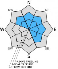
For 7000 ft. to 8000 ft.
Wednesday Wednesday Night Thursday
Weather: Partly cloudy then becoming sunny. Clear Sunny
Temperatures: 42 to 49 deg. F. 23 to 29 deg. F. 46 to 53 deg. F.
Mid Slope Winds:
Wind Speed: Light winds Light winds Light winds
Expected snowfall: 0 0 0
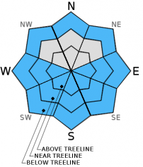
For 8000 ft. to 9000 ft.
Wednesday Wednesday Night Thursday
Weather: Partly cloudy then becoming sunny. Clear Sunny
Temperatures: 40 to 46 deg. F. 21 to 28 deg. F. 42 to 49 deg. F.
Ridge Top Winds: SE E SW
Wind Speed: 10 to 15mph. 10 to 15mph in the evening becoming light. 10 to 15mph.
Expected snowfall: 0 0 0
Disclaimer

This avalanche advisory is provided through a partnership between the Tahoe National Forest and the Sierra Avalanche Center. This advisory covers the Central Sierra Nevada Mountains between Yuba Pass on the north and Ebbetts Pass on the south. Click here for a map of the forecast area. This advisory applies only to backcountry areas outside established ski area boundaries. This advisory describes general avalanche conditions and local variations always occur. This advisory expires 24 hours after the posted time unless otherwise noted. The information in this advisory is provided by the USDA Forest Service who is solely responsible for its content.

For a recorded version of the Avalanche Advisory call (530) 587-3558 x258