THIS AVALANCHE FORECAST EXPIRED ON March 7, 2016 @ 6:45 am
Avalanche Forecast published on March 6, 2016 @ 6:45 am
Issued by Brandon Schwartz - Tahoe National Forest

Following a period of HIGH avalanche danger last night, CONSIDERABLE avalanche danger will exist today near and above treeline on all aspects on slopes 35 degrees and steeper due to newly formed wind slabs. In wind protected areas below treeline, MODERATE avalanche danger exists on slopes 35 degrees and steeper due to storm slabs. Large human triggered avalanches are likely today. Another period of HIGH avalanche danger is expected tonight into early tomorrow morning with natural avalanches likely.
 

3. Considerable

?

Above Treeline
Dangerous avalanche conditions. Careful snowpack evaluation, cautious route-finding and conservative decision-making essential.

3. Considerable

?

Near Treeline
Dangerous avalanche conditions. Careful snowpack evaluation, cautious route-finding and conservative decision-making essential.

2. Moderate

?

Below Treeline
Heightened avalanche conditions on specific terrain features. Evaluate snow and terrain carefully; identify features of concern.
    Dangerous avalanche conditions. Careful snowpack evaluation, cautious route-finding and conservative decision-making essential.
Avalanche Problem 1: Wind Slab
  • Type ?
  • Aspect/Elevation ?
  • Likelihood ?
    Certain
    Very Likely
    Likely
    Possible
    Unlikely
  • Size ?
    Historic
    Very Large
    Large
    Small

New snow and winds last night created wind slabs several feet deep in wind loaded areas near and above treeline. The vast majority of unstable wind slabs will exist on NW-N-NE-E-SE aspects. Wind slabs may be found on S-SW-W aspects in isolated areas. Avalanche size could be large and destructive depending on location and depth of wind loading. These new wind slabs have been deposited on top of unstable wind slabs formed Friday night.

Look for areas of recent wind loading and avoid steep wind loaded slopes. Use clues such as recent avalanche activity, blowing snow, cornice formations, and wind pillows to identify wind loaded areas to be avoided. Human triggered shooting cracks are a sign of instability in the immediate area and cause to seek out terrain less than 30 degrees in slope angle.

Avalanche Problem 2: Storm Slab
  • Type ?
  • Aspect/Elevation ?
  • Likelihood ?
    Certain
    Very Likely
    Likely
    Possible
    Unlikely
  • Size ?
    Historic
    Very Large
    Large
    Small

In wind protected areas below treeline, storm slab instability is possible today on all aspects. The snow that has fallen over the past 40 hours has been variable in both density and moisture content, setting up significant layering within the recent storm snow. Human triggered storm slab avalanches are an ongoing concern today in steep areas below treeline. Large openings are not required. Tree density must be too tight to ski or snowmobile through in order to anchor the snowpack in place. Trees you can ski or ride through only provide protection from the wind and wind related avalanche problems, not from storm slabs.

Clues such as recent avalanche activity below treeline, shooting cracks, and/or snowpack collapse indicate that conditions are locally unstable. Large column snowpit tests can be helpful in finding signs of instability when the more obvious clues are not observed.

recent observations

Observations made yesterday on Jake's Peak (West Shore Tahoe area) revealed widespread small natural and human triggered loose wet avalanches as well as signs of unstable wind slabs. Signs of unstable wet snow existed on all aspects all the way up to the summit around 9,200'. New snow amounts in the area from Friday night ranged from 2 to 3 inches around 7,500' to 8 inches above 8,200'. Skier triggered cracking of wind slabs was noted in wind loaded areas along the summit ridgeline. At mid day yesterday wind slab depth was around 1 foot. See specific observations below for more info, photos, and video.

Weather and CURRENT CONDITIONS
weather summary

A period of high intensity rain and snowfall occurred last night through early this morning. Snow level held around 8,000' for much of yesterday evening before starting to lower around midnight. Snow level this morning is down around 5,000'. Above 7,000', new snow amounts of 10 to 18 inches have been observed across the forecast area as of 5:30 am. Snowfall intensity is expected to taper to showers today as a break occurs in between weather systems. Continued strong SW winds will occur today, increasing to gale force again tonight. Maximum daytime air temperatures for areas above 7,000' today will range from the upper teens to the upper 20s. A second powerful storm system will impact the forecast area late tonight into tomorrow morning with snow level lowering to around 4,000'

CONDITIONS ALONG THE SIERRA CREST BETWEEN 8200 FT. AND 9200 FT. IN THE LAST 24 HOURS
6am temperature: 22 to 28 deg. F.
Max. temperature: 33 to 36 deg. F.
Average ridgetop wind direction: SW
Average ridgetop wind speed: 44 mph
Maximum ridgetop wind gust: 110 mph
New snowfall: 10 to 18 inches
Total snow depth: 78 to 100 inches
Two-Day Mountain Weather Forecast Produced in partnership with the Reno NWS
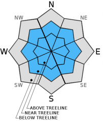
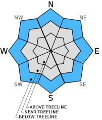
For 7000 ft. to 8000 ft.
Sunday Sunday Night Monday
Weather: Cloudy skies with snow in the morning. Snow likely in the afternoon. Cloudy skies with snow. Cloudy skies with snow.
Temperatures: 22 to 29 deg. F. 15 to 22 deg. F. 23 to 30 deg. F.
Mid Slope Winds: SW SW SW shifting to W
Wind Speed: 25 to 35 mph with gusts to 50 mph. 30 to 35 mph with gusts to 50 mph, increasing to 45 to 50 mph with gusts to 70 mph after midnight. 35 to 40 mph with gusts to 60 mph, decreasing to 10 to 15 mph in the afternoon.
Expected snowfall: 3 to 5 8 to 12 3 to 6
For 8000 ft. to 9000 ft.
Sunday Sunday Night Monday
Weather: Cloudy skies with snow in the morning. Snow likely in the afternoon. Cloudy skies with snow. Cloudy skies with snow.
Temperatures: 18 to 25 deg. F. 13 to 20 deg. F. 19 to 26 deg. F.
Ridge Top Winds: SW SW SW to W
Wind Speed: 40 to 50 mph with gusts to 75 mph. 45 to 50 mph with gusts to 70 mph, increasing to 70 to 75 mph with gusts to 105 mph after midnight. 55 to 60 mph with gusts to 80 mph, decreasing to 15 to 20 mph with gusts to 35 mph in the afternoon.
Expected snowfall: 3 to 5 9 to 12 3 to 6
Disclaimer

This avalanche advisory is provided through a partnership between the Tahoe National Forest and the Sierra Avalanche Center. This advisory covers the Central Sierra Nevada Mountains between Yuba Pass on the north and Ebbetts Pass on the south. Click here for a map of the forecast area. This advisory applies only to backcountry areas outside established ski area boundaries. This advisory describes general avalanche conditions and local variations always occur. This advisory expires 24 hours after the posted time unless otherwise noted. The information in this advisory is provided by the USDA Forest Service who is solely responsible for its content.