

The last avalanche forecast for the 2023-2024 season will post on April 21st. Thank you to all who contributed to the avalanche center this season through observations, volunteer time, and/or financial contributions.
In partnership with: 
The last avalanche forecast for the 2023-2024 season will post on April 21st. Thank you to all who contributed to the avalanche center this season through observations, volunteer time, and/or financial contributions.
|
February 26, 2012 at 7:45 am |
|
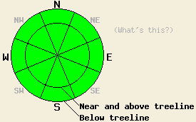
Avalanche danger remains LOW for all elevations and aspects. Normal caution is advised. An increase in avalanche danger may occur this week, especially if the upper end of forecast snowfall amounts are reached. |
|
|
|
Transitional weather will occur today as a two part weather system moves into the forecast area this afternoon and overnight. Cloud cover will increase during the day, especially during the afternoon hours. Significant cold air is associated with this system. Air temperatures today are expected to remain below freezing above 8,000' with near freezing air temperatures below 8,000'. Light ridgetop winds early this morning will become moderate in speed out of the south to southwest as the day progresses. The big news is for up to 4 inches of low density snow expected tomorrow above 7,000'. A significant cool down will occur with well below freezing air temperatures expected for all elevations on Monday and Tuesday. The outlook is good for more snow this week.
Recent observations from across the forecast area including those made yesterday on Silver Peak (Pole Creek area) continue to show widespread stable snowpack conditions (pit profile, more info). Well established melt-freeze conditions exist on southerly aspects and breakable crust exists in nearly all other areas. Isolated wind protected areas above 9,500' on northerly aspects are the only exception to the presence of melt freeze or breakable crust. The dormant persistent weak layer of crusts and facets in the upper portion of the snowpack remains widespread, especially along the Sierra Crest. This layer is weak but stable at this time. Additional snow loading this week may change that stability
Today's Avalanche Concerns:
Avalanche concerns for today are few. Tomorrow and later this week could be a different story. Air temperatures remaining near or below freezing today will allow for little to no melting of surface snow on southerly aspects. Wet snow instability will not occur. The crust/facet combo in the upper portion of the snowpack remains very weak in many areas, however the overlying slabs are thin and brittle. Failure and propagation along this weak layer remains unlikely today. The combination of new snow and wind loading tomorrow may be enough for this persistent weak layer to once again become reactive. If forecast new snow amounts for tomorrow verify, a trend of increasing avalanche danger will occur. Further additional new snow loading has the potential to increase avalanche danger this week.
Avalanche danger remains LOW for all elevations and aspects. Normal caution is advised. An increase in avalanche danger may occur this week, especially if the upper end of forecast snowfall amounts are reached.
| 0600 temperature: | 16 to 25 deg. F. |
| Max. temperature in the last 24 hours: | 28 to 39 deg. F. |
| Average wind direction during the last 24 hours: | West yesterday, northeast last night. |
| Average wind speed during the last 24 hours: | 15 mph |
| Maximum wind gust in the last 24 hours: | 41 mph |
| New snowfall in the last 24 hours: | O inches |
| Total snow depth: | 21 to 33 inches |
For 7000-8000 ft: |
|||
| Sunday: | Sunday Night: | Monday: | |
| Weather: | Partly cloudy skies, becoming mostly cloudy. | Mostly cloudy skies with a slight chance of snow showers. | Cloudy skies with snow showers. |
| Temperatures: | 29 to 35 deg. F. | 7 to 14 deg. F. | 19 to 25 deg. F. |
| Wind direction: | S to SW | SW | W |
| Wind speed: | 10 to 15 mph with gusts to 25 mph in the afternoon. | 15 to 25 mph with gusts to 35 mph. | 15 to 25 mph with gusts to 40 mph. |
| Expected snowfall: | O in. | 0 to trace in. | 2 to 4 in. |
For 8000-9000 ft: |
|||
| Sunday: | Sunday Night: | Monday: | |
| Weather: | Partly cloudy skies, becoming mostly cloudy. | Mostly cloudy skies with a slight chance of snow showers. | Cloudy skies with snow showers. |
| Temperatures: | 25 to 31 deg. F. | 2 to 9 deg. F. | 12 to 18 deg. F. |
| Wind direction: | S to SW | SW | W |
| Wind speed: | 15 to 25 with gusts to 30 mph. Gusts increasing to 40 mph in the afternoon. | 20 to 30 mph with gusts to 45 mph. | 20 to 30 mph with gusts to 45 mph. |
| Expected snowfall: | O in. | 0 to trace in. | 2 to 4 in. |


This website is owned and maintained by the non-profit arm of the Sierra Avalanche Center. Some of the content is updated by the USDA avalanche forecasters including the forecasts and some observational data. The USDA is not responsible for any advertising, fund-raising events/information, or sponsorship information, or other content not related to the forecasts and the data pertaining to the forecasts.