

The last avalanche forecast for the 2023-2024 season will post on April 21st. Thank you to all who contributed to the avalanche center this season through observations, volunteer time, and/or financial contributions.
In partnership with: 
The last avalanche forecast for the 2023-2024 season will post on April 21st. Thank you to all who contributed to the avalanche center this season through observations, volunteer time, and/or financial contributions.
|
March 5, 2012 at 7:33 am |
|
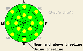
Avalanche danger is LOW with pockets of MODERATE danger both above and below treeline on NW-N-NE aspects on slopes 35 degrees and steeper due to ongoing deep slab instability. Avalanche danger is LOW with pockets of MODERATE danger forming today both above and below treeline on E-SE-S-SW-W aspects on slopes 37 degrees and steeper due to wet snow instability. Large destructive human triggered avalanches remain possible today in isolated areas.
|
|
|
|
Transitional weather will occur today ahead of an approaching weather system. Sunny skies this morning will give way to increasing cloud cover this afternoon. An air temperature inversion is in place over much of the forecast area this morning. Below freezing air temperatures exist this morning below about 6,500', while air temperatures above 6,700' are in the 30s and 40s. Daytime highs are once again forecast to warm into the 40s and 50s today for areas above 7,000'. Ridgetop winds remain out of the southwest this morning and are beginning to increase in speed ahead of the approaching weather system. Wind speeds are forecast to become strong by this afternoon and gale force tonight with gusts to 110mph possible over the higher terrain. Snowfall is expected to begin after midnight tonight and continue through tomorrow with 2 to 6 inches possible. Cold front passage will cause a significant cool down of air temperatures tomorrow with daytime highs above 7,000' forecast for the teens and 20s.
Observations from around the forecast area over the past few days have shown increased variability in the amount of the ongoing instability on the persistent weak layer of crusts and faceted snow just below the base of the recent storm snow. Concerns for human triggered deep slab avalanches are ongoing, but the areas where this might occur are becoming pocket like in nature. Areas of unstable snow linger within surrounding areas of stable snow. Yesterday on Mt. Judah (Donner Summit area), Mt. Tallac (Desolation Wilderness area), near Red Lake (Carson Pass area), and in King's Realm (near Bear Valley) propagation tests performed on N and NE aspects in above treeline and below treeline terrain indicated that this crust/facet weak layer still holds the potential to allow fractures to travel significant distances through the snowpack once triggered. Snowpit test results indicating likely propagation were also received from a party traveling on a NE aspect below treeline on Becker Peak (Echo Summit area). In Underwood Bowl (near Bear Valley) stable test results were observed in near treeline areas on a N aspect slope at 8,600' (click here for photos, videos, pit profiles, and more info on the above observations). This persistent weak layer is becoming harder trigger, but it is still out there.
Today's Primary Avalanche Concern: Persistent Deep Slabs
The recent storm snow is now a cohesive slab 1 to 4 feet thick that in many areas is sitting on top of the persistent weak layer of crusts and facets that formed in late January and early February. Triggering slab avalanches that fail within the recent new snow is unlikely at this time. In areas where the persistent weak layer remains, the area of greatest relative weakness exists deep within the snowpack at the crust/facet layer just below the bottom of the recent storm snow. This is where any snowpack failure at this time is likely to occur. This weak layer exists on NW-N-NE aspects both above and below treeline. Digging into the snowpack in these areas reveals a very easily identifiable layer and snow crystal change at the bottom of the storm snow that is obvious to both sight and feel. Large human triggered deep slab avalanches remain possible today both above and below treeline on NW-N-NE aspects. Areas near exposed rock outcrops and other similar trigger points are locations where triggering a deep slab avalanche is more likely. Observations are showing increasing variability regarding the stability of this weak layer around the forecast area. Locations of stable observations are often not very far away from locations indicating significant ongoing instability. Exercise caution and conservative decision making as it is easy to travel from areas of stability to areas instability over a short distance.
Today's Secondary Avalanche Concern: Warming Instability
While some amount of snow surface refreeze was able to occur last night due to radiational cooling under clear skies, near and above freezing air temperatures at the mid and upper elevations will rapidly warm this morning. The best refreeze is expected to have occurred along the mountain valley floors and above 9,000'. Much of the middle elevation areas are expected to have undergone only a very superficial refreeze of the snow surface last night. With above freezing air temperatures existing on many slopes at sunrise this morning, areas of wet snow instability will form quickly again today on E-SE-S-SW-W aspects at all elevations. Natural and human triggered wet loose snow avalanche activity and roller ball activity are expected to continue in steep terrain, but not as much as in the past two days. The recent new snow continues to transition from unconsolidated storm snow to consolidated melt-freeze conditions and has completed this transition only in areas where the snowpack is very shallow. Be conservative with travel above cliff bands, gullies, and other terrain traps that greatly magnify the consequences of being caught and carried by an otherwise inconsequential small loose snow avalanche.
Avalanche danger is LOW with pockets of MODERATE danger both above and below treeline on NW-N-NE aspects on slopes 35 degrees and steeper due to ongoing deep slab instability. Avalanche danger is LOW with pockets of MODERATE danger forming today both above and below treeline on E-SE-S-SW-W aspects on slopes 37 degrees and steeper due to wet snow instability. Large destructive human triggered avalanches remain possible today in isolated areas.
| 0600 temperature: | 32 to 37 deg. F. |
| Max. temperature in the last 24 hours: | 48 to 52 deg. F. |
| Average wind direction during the last 24 hours: | Southwest |
| Average wind speed during the last 24 hours: | 15 mph |
| Maximum wind gust in the last 24 hours: | 34 mph |
| New snowfall in the last 24 hours: | O inches |
| Total snow depth: | 28 to 53 inches |
For 7000-8000 ft: |
|||
| Monday: | Monday Night: | Tuesday: | |
| Weather: | Sunny skies, becoming partly cloudy. | Mostly cloudy skies with a chance of snow showers after midnight. | Cloudy skies with snow in the morning. Mostly cloudy skies with snow likely in the afternoon. |
| Temperatures: | 45 to 54 deg. F. | 22 to 26 deg. F. | 20 to 28 deg. F. |
| Wind direction: | SW | SW | W |
| Wind speed: | 20 to 25 mph with gusts to 40 mph, increasing to 35 to 40 mph with gusts to 65 mph in the afternoon. | 35 to 45 mph with gusts to 70 mph. | 20 to 30 mph with gusts to 50 mph. Gusts decreasing to 40 mph in the afternoon. |
| Expected snowfall: | O in. | Up to 1 in. | 2 to 4 in. |
For 8000-9000 ft: |
|||
| Monday: | Monday Night: | Tuesday: | |
| Weather: | Sunny skies, becoming partly cloudy. | Mostly cloudy skies with a chance of snow showers after midnight. | Cloudy skies with snow in the morning. Mostly cloudy skies with snow likely in the afternoon. |
| Temperatures: | 40 to 47 deg. F. | 15 to 22 deg. F. | 18 to 23 deg. F. |
| Wind direction: | SW | SW | W |
| Wind speed: | 30 to 35 mph with gusts to 50 mph, increasing to 50 to 55 mph with gusts to 80 mph in the afternoon. | 60 to 70 mph with gusts to 110 mph. | 30 to 40 mph with gusts to 60 mph. |
| Expected snowfall: | O in. | Up to 1 in. | 3 to 6 in. |


This website is owned and maintained by the non-profit arm of the Sierra Avalanche Center. Some of the content is updated by the USDA avalanche forecasters including the forecasts and some observational data. The USDA is not responsible for any advertising, fund-raising events/information, or sponsorship information, or other content not related to the forecasts and the data pertaining to the forecasts.