The last avalanche forecast for the 2023-2024 season will post on April 21st. Thank you to all who contributed to the avalanche center this season through observations, volunteer time, and/or financial contributions.
In partnership with: 
The last avalanche forecast for the 2023-2024 season will post on April 21st. Thank you to all who contributed to the avalanche center this season through observations, volunteer time, and/or financial contributions.
| Date and time of observation or avalanche occurrence | Location | Media | Observation made by |
|---|---|---|---|
|
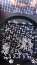
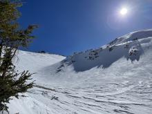
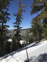
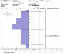
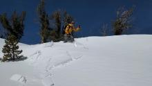
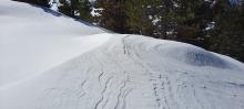
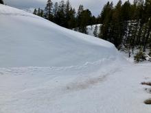
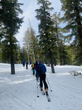
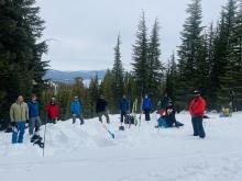
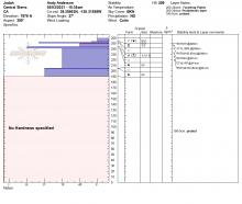
03/07/2021 - 09:30 Avalanche Observation |
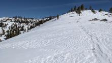
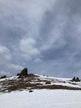
Shirley Canyon Cabin Creek, Deep Creek, or Pole Creek Area |
   |
Educator Alpenglow Expeditio |
|
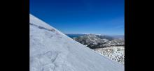
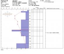
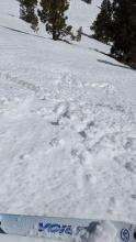
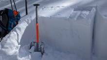
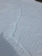
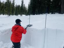
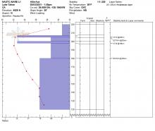
03/06/2021 - 15:10 Snowpack Observation |
Waterhouse Peak Luther Pass Area (including Job and Freel) |
     |
Public |
|
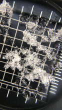
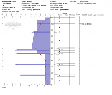
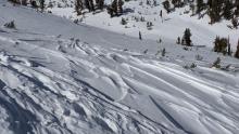
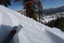
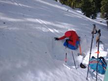
03/06/2021 - 14:00 Snowpack Observation |
Freel Peak Luther Pass Area (including Job and Freel) |
   |
Public |
|
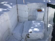
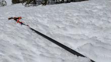
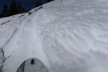
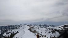
03/06/2021 - 13:30 Snowpack Observation |
Waterhouse Peak Luther Pass Area (including Job and Freel) |
|
Public |
|
03/06/2021 - 12:30 Snowpack Observation |
Waterhouse Knob -- False Summit Luther Pass Area (including Job and Freel) |
 |
Public |
|
03/06/2021 - 12:30 Snowpack Observation |
Top of Waterhouse 2 Luther Pass Area (including Job and Freel) |
  |
Public |
|
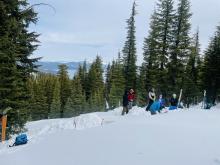
03/06/2021 - 10:45 Snowpack Observation |
Incline Peak Mount Rose Area |
  |
Forecaster |
|
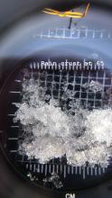
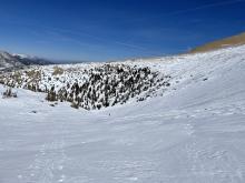
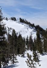
03/06/2021 - 10:30 Snowpack Observation |
Observation point Shirley Canyon Cabin Creek, Deep Creek, or Pole Creek Area |
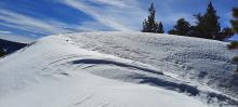  |
Guide Alpenglow Expeditio |
|
03/05/2021 - 13:30 Snowpack Observation |
Relay Peak Mount Rose Area |
     |
Public |
|
03/05/2021 - 11:22 Snowpack Observation |
Talking Mountain Echo Summit Area |
  |
Public |
|
03/04/2021 - 12:00 Snowpack Observation |
Johnson Canyon Donner Summit Area |
       |
Forecaster |
|
03/03/2021 - 14:15 Snowpack Observation |
Peak 9452 Carson Pass Area |
      |
Professional Observer |
|
03/03/2021 - 13:30 Snowpack Observation |
Ellis Peak West Shore Area |
     |
Guide NORTH AMERICAN SKI TRAINING AND CLIMBI |
|
03/03/2021 - 11:00 Snowpack Observation |
Mt. Judah Donner Summit Area |
    |
Forecaster |
|
03/02/2021 - 14:30 Snowpack Observation |
Ellis Peak West Shore Area |
  |
Guide NORTH AMERICAN SKI TRAINING AND CLIMBI |


This website is owned and maintained by the non-profit arm of the Sierra Avalanche Center. Some of the content is updated by the USDA avalanche forecasters including the forecasts and some observational data. The USDA is not responsible for any advertising, fund-raising events/information, or sponsorship information, or other content not related to the forecasts and the data pertaining to the forecasts.