THIS AVALANCHE FORECAST EXPIRED ON February 8, 2017 @ 6:50 am
Avalanche Forecast published on February 7, 2017 @ 6:50 am
Issued by Brandon Schwartz - Tahoe National Forest

HIGH avalanche danger exists above 8,500' with CONSIDERABLE danger below 8,500'. Wind slab, wet slab, and wet loose avalanche problems are expected today. Travel in or below backcountry avalanche terrain or on or below slopes steeper than 35 degrees is not recommended today. Be aware of avalanche run out zones and the potential for large avalanches coming from high above. An avalanche warning remains in effect until 7 am Wednesday February 8, 2017.

4. High

?

Above Treeline
Very dangerous avalanche conditions. Travel in avalanche terrain not recommended.

4. High

?

Near Treeline
Very dangerous avalanche conditions. Travel in avalanche terrain not recommended.

3. Considerable

?

Below Treeline
Dangerous avalanche conditions. Careful snowpack evaluation, cautious route-finding and conservative decision-making essential.
    Very dangerous avalanche conditions. Travel in avalanche terrain not recommended.
Avalanche Problem 1: Wind Slab
  • Type ?
  • Aspect/Elevation ?
  • Likelihood ?
    Certain
    Very Likely
    Likely
    Possible
    Unlikely
  • Size ?
    Historic
    Very Large
    Large
    Small

The combination of high intensity snowfall and gale force winds over the upper elevations makes large wind slab avalanches very likely today. These wind slab avalanches are expected to initiate in avalanche start zones above 8,500'. Avalanches could run far towards the valley floor, well below snow level. Wind slab avalanches are most likely to occur on NW-N-NE-E-SE-S aspects today in near and above treeline terrain. Wind slabs could form in more limited areas on SW-W aspects as well as below treeline due to the strength of the winds.

Avoid areas where blowing snow is depositing. Travel on or below backcountry slopes that hold top load or cross load cornice formations is not recommended.

Avalanche Problem 2: Wet Slab
  • Type ?
  • Aspect/Elevation ?
  • Likelihood ?
    Certain
    Very Likely
    Likely
    Possible
    Unlikely
  • Size ?
    Historic
    Very Large
    Large
    Small

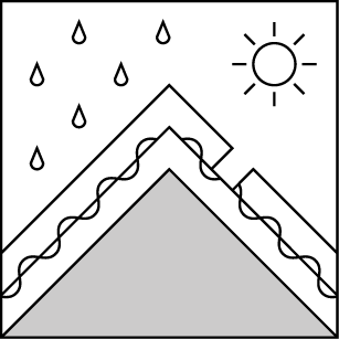
Snow level has risen to 8,500' to 10,000' this morning. Rain on new snow has the potential to trigger wet slab avalanches below snow level on all aspects. Any weak layers that exist within the storm snow deposited over the past 24 to 36 hours could fail as a wet slab avalanche. Even relatively smaller wet slab avalanches can be destructive due to the increase in mass of the rain wetted snowpack.

Avoid travel on or below slopes 35 degrees and steeper.

Avalanche Problem 3: Loose Wet
  • Type ?
  • Aspect/Elevation ?
  • Likelihood ?
    Certain
    Very Likely
    Likely
    Possible
    Unlikely
  • Size ?
    Historic
    Very Large
    Large
    Small

Rising snow level will allow for increasing amounts of rain on new and old snow today. In rain on snow areas where the snowpack does not fail as a wet slab avalanche, wet loose avalanches are expected to occur on slopes 35 degrees and steeper on all aspects.

Avoid travel on or below slopes where naturally occurring roller balls or signs of loose wet avalanches exist.

recent observations

Observations made and received yesterday from the West Show Tahoe, Echo Summit, and Donner Summit areas revealed similar information. Strong to gale force ridgetop winds and significant amounts of blowing snow were observed. Newly formed wind slabs were difficult to trigger, but cracking was observed in some wind loaded areas. Snowpit tests indicated several weak layers within the storm snow with very limited signs of likely propagation. Snow level had risen to around 7,000' yesterday afternoon with increasing amounts of roller ball activity at and below 7,500'.

Weather and CURRENT CONDITIONS
weather summary

The storm systems currently moving through the forecast area deposited 1 to 3 inches of rain water equivalent with 10 to 23 inches of new snow above 7,000' over the past 24 hours. An additional 4 to 6 inches of rain water equivalent is expected to fall this morning through this evening. Snow level has risen this morning up to around 8,500' to 10,000'. Accumulating snow of 1 to 2 feet is expected today over the highest elevations that remain above snow level. Winds are gale force out of the SW with ridgetop gusts to 137 mph recorded so far this morning. Ridgetop gusts could easily reach 150+ mph today. Moderate to high intensity precipitation is expected to continue into tonight before tapering off tomorrow.


CONDITIONS ALONG THE SIERRA CREST BETWEEN 8200 FT. AND 9200 FT. IN THE LAST 24 HOURS
6am temperature: 32 to 36 deg. F.
Max. temperature: 32 to 36 deg. F.
Average ridgetop wind direction: SW
Average ridgetop wind speed: 80 mph
Maximum ridgetop wind gust: 137 mph
New snowfall: 10 to 23 inches
Total snow depth: 118 to 160 inches
Two-Day Mountain Weather Forecast Produced in partnership with the Reno NWS
For 7000 ft. to 8000 ft.
Tuesday Tuesday Night Wednesday
Weather: Cloudy skies with rain. Cloudy skies with rain. Cloudy skies with rain likely in the morning. A chance of rain and snow in the afternoon.
Temperatures: 37 to 40 deg. F. 33 to 38 deg. F. 40 to 45 deg. F.
Mid Slope Winds: SW SW SW
Wind Speed: 25 to 40 mph with gusts to 80 mph. 20 to 35 mph with gusts to 70 mph. 15 to 25 mph with gusts to 60 mph.
Expected snowfall: 0 0 0
For 8000 ft. to 9000 ft.
Tuesday Tuesday Night Wednesday
Weather: Cloudy skies with rain and snow. Accumulating snow limited to areas above 8,500'. Cloudy skies with rain and snow. Accumulating snow limited to areas above 8,500'. Cloudy skies with rain and snow likely in the morning. A chance of rain and snow in the afternoon.
Temperatures: 31 to 36 deg. F. 30 to 35 deg. F. 33 to 38 deg. F.
Ridge Top Winds: SW SW SW
Wind Speed: 55 to 75 mph with gusts up to 145 mph. 40 to 55 mph with gusts to 115 mph, decreasing to 30 to 50 mph with gusts to 90 mph after midnight. 30 to 40 mph with gusts to 90 mph, increasing to 30 to 50 mph with gusts to 100 mph in the afternoon.
Expected snowfall: 10 to 20 6 to 12 0 to 3
Disclaimer

This avalanche advisory is provided through a partnership between the Tahoe National Forest and the Sierra Avalanche Center. This advisory covers the Central Sierra Nevada Mountains between Yuba Pass on the north and Ebbetts Pass on the south. Click here for a map of the forecast area. This advisory applies only to backcountry areas outside established ski area boundaries. This advisory describes general avalanche conditions and local variations always occur. This advisory expires 24 hours after the posted time unless otherwise noted. The information in this advisory is provided by the USDA Forest Service who is solely responsible for its content.

For a recorded version of the Avalanche Advisory call (530) 587-3558 x258