THIS AVALANCHE FORECAST EXPIRED ON January 12, 2017 @ 6:45 am
Avalanche Forecast published on January 11, 2017 @ 6:45 am
Issued by Brandon Schwartz - Tahoe National Forest

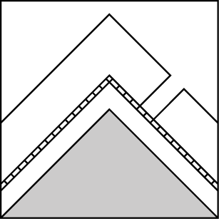
HIGH avalanche danger continues for all elevations and aspects due to a combination of wind slab, storm slab, and deep slab avalanche problems. Travel in avalanche terrain, on or below slopes 30 degrees and steeper is not recommended. Avalanches could run into areas of mature forest. A backcountry avalanche warning remains in effect through 5 pm today.

4. High

?

Above Treeline
Very dangerous avalanche conditions. Travel in avalanche terrain not recommended.

4. High

?

Near Treeline
Very dangerous avalanche conditions. Travel in avalanche terrain not recommended.

4. High

?

Below Treeline
Very dangerous avalanche conditions. Travel in avalanche terrain not recommended.
    Very dangerous avalanche conditions. Travel in avalanche terrain not recommended.
Avalanche Problem 1: Wind Slab
  • Type ?
  • Aspect/Elevation ?
  • Likelihood ?
    Certain
    Very Likely
    Likely
    Possible
    Unlikely
  • Size ?
    Historic
    Very Large
    Large
    Small

Natural wind slab avalanche activity occurred yesterday. Ongoing gale force SW winds and additional snowfall on top of the numerous feet of new snow already received will continue to create very large wind slabs in near treeline and above treeline terrain mainly on NW-N-NE-E-SE-S aspects. Wind slabs may exist in more isolated areas on SW-W aspects and in below treeline areas as well.

Travel on or below slopes steeper than 30 degrees is not recommended today. Very large cornices exist along ridgelines, presenting an additional hazard.

Avalanche Problem 2: Storm Slab
  • Type ?
  • Aspect/Elevation ?
  • Likelihood ?
    Certain
    Very Likely
    Likely
    Possible
    Unlikely
  • Size ?
    Historic
    Very Large
    Large
    Small

Human triggered storm slab avalanches were reported yesterday from below treeline areas. Multiple feet of new snow accumulation in wind protected areas combined with fluctuating snow levels and air temperatures has created storm slabs on all aspects in near and below treeline terrain. An upside down storm snow structure exists in many areas with numerous density changes within the storm snow.

Travel on or below slopes 30 degrees and steeper is not recommended. Trees will need to be too tight to move through on skis or a snowmobile to protect from direct human triggering of this avalanche problem. Keep in mind that avalanches from above can move through mature forest.

Avalanche Problem 3: Deep Slab
  • Type ?
  • Aspect/Elevation ?
  • Likelihood ?
    Certain
    Very Likely
    Likely
    Possible
    Unlikely
  • Size ?
    Historic
    Very Large
    Large
    Small

Several possibilities exist for deep slab avalanches characterized by failure more than 3 feet deep in the snowpack to occur today. Drifting snow associated with wind slabs has become deep enough to qualify as deep slabs. Numerous density changes exist within the storm snow. Failure much deeper in the snowpack down to the depth of the Dec 15 rain crust remains possible, especially above 9,000'. Deep slabs could occur on any aspect at any elevation.

Human involvement in any deep slab avalanches will be difficult to survive given the expected very large to historic avalanche size. Travel on or below slopes 30 degrees and steeper is not recommended. Avoid historic avalanche run out zones characterized by small to medium sized trees with steeper slopes above.

recent observations

Numerous avalanches ranging from small to very large were reported yesterday around the forecast area. A skier triggered storm slab avalanche occurred on Powderhouse Peak (Luther Pass area) on a N aspect at around 9,100'. The avalanche was reported to have a 1 foot crown, propagate over 300 feet wide, ran 1,100 vertical feet through mature forest, and overran the skin track below. No one was caught in the avalanche. Additional sensitive storm slabs and avalanche activity was reported below treeline yesterday afternoon near Coyote Rock outside the community of Meyers, CA. Sensitive wind slabs with easy skier triggering were observed on test slopes in Negro Canyon (Donner Summit area). Signs of larger natural wind slab avalanche activity existed in obvious avalanche paths in the area.

Weather and CURRENT CONDITIONS
weather summary

Snowfall continues across the forecast area. Snow levels rose as high as 7,400' last night in some areas and have fallen below 5,000' this morning as colder air moves into the region. Convective snow showers will occur today allowing for localized areas of high intensity snowfall to continue. Areas outside the convective showers will pick up just a few additional inches today. Overall snowfall intensity is forecast to decrease later today, but the areas under convective snow showers will remain the exception. All available ridgetop wind sensors remain off line again this morning, but gale force SW winds remain forecast for today with gusts to 100 mph expected. Light snowfall is forecast for tonight into Thursday. Light to moderate speed E winds and colder air temperatures are expected during the day on Thursday.

CONDITIONS ALONG THE SIERRA CREST BETWEEN 8200 FT. AND 9200 FT. IN THE LAST 24 HOURS
6am temperature: 23 to 27 deg. F.
Max. temperature: 30 to 32 deg. F.
Average ridgetop wind direction: SW
Average ridgetop wind speed: (No data available) mph
Maximum ridgetop wind gust: (No data available) mph
New snowfall: 17 to 30 inches
Total snow depth: 86 to 118 inches
Two-Day Mountain Weather Forecast Produced in partnership with the Reno NWS
For 7000 ft. to 8000 ft.
Wednesday Wednesday Night Thursday
Weather: Cloudy skies with snow. Blizzard conditions in the morning. Cloudy skies with snow showers likely in the evening. A chance of snow after midnight. Cloudy skies with snow.
Temperatures: 27 to 32 deg. F. 12 to 18 deg. F. 21 to 26 deg. F.
Mid Slope Winds: SW SW E
Wind Speed: 20 to 35 mph with gusts to 60 mph. 15 to 25 mph. Gusts to 40 mph decreasing to 30 mph after midnight. Light winds
Expected snowfall: Expected 3 to 8 in., Possible 8 to 12 1 to 3 2 to 5
For 8000 ft. to 9000 ft.
Wednesday Wednesday Night Thursday
Weather: Cloudy skies with snow. Blizzard conditions in the morning. Cloudy skies with snow showers likely in the evening. A chance of snow after midnight. Cloudy skies with snow.
Temperatures: 24 to 30 deg. F. 10 to 15 deg. F. 16 to 21 deg. F.
Ridge Top Winds: SW SW E
Wind Speed: 30 to 50 mph with gusts to 100 mph, decreasing to 25 to 40 mph with gusts to 85 mph in the afternoon. 20 to 30 mph. Gusts to 70 mph, decreasing to 55 mph after midnight. 10 to 15 mph. Gusts to 40 mph, decreasing to 30 mph in the afternoon.
Expected snowfall: Expected 4 to 10 in., Possible 10 to 14 1 to 3 2 to 5
Disclaimer

This avalanche advisory is provided through a partnership between the Tahoe National Forest and the Sierra Avalanche Center. This advisory covers the Central Sierra Nevada Mountains between Yuba Pass on the north and Ebbetts Pass on the south. Click here for a map of the forecast area. This advisory applies only to backcountry areas outside established ski area boundaries. This advisory describes general avalanche conditions and local variations always occur. This advisory expires 24 hours after the posted time unless otherwise noted. The information in this advisory is provided by the USDA Forest Service who is solely responsible for its content.

For a recorded version of the Avalanche Advisory call (530) 587-3558 x258