THIS AVALANCHE FORECAST EXPIRED ON March 16, 2020 @ 6:47 am
Avalanche Forecast published on March 15, 2020 @ 6:47 am
Issued by Brandon Schwartz - Tahoe National Forest

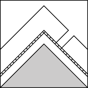
HIGH avalanche danger exists at all elevations in the backcountry at this time. Conditions are dangerous and travel in or below avalanche terrain is not recommended. This includes steep slopes below treeline.

4. High

?

Above Treeline
Very dangerous avalanche conditions. Travel in avalanche terrain not recommended.

4. High

?

Near Treeline
Very dangerous avalanche conditions. Travel in avalanche terrain not recommended.

4. High

?

Below Treeline
Very dangerous avalanche conditions. Travel in avalanche terrain not recommended.
    Very dangerous avalanche conditions. Travel in avalanche terrain not recommended.
Avalanche Problem 1: Wind Slab
  • Type ?
  • Aspect/Elevation ?
  • Likelihood ?
    Certain
    Very Likely
    Likely
    Possible
    Unlikely
  • Size ?
    Historic
    Very Large
    Large
    Small

Large amounts of wind drifted snow in above treeline and near treeline areas has created a wind slab avalanche problem. This exists mainly in lee areas on NW-N-NE-E-SE-S aspects with previous snow cover. Avalanche size is expected at D2 to D3. Avoid travel in or below avalanche terrain. Avalanches may run significant distances into flat areas below steep slopes. Keep in mind that poor visibility may make it difficult to see steep slopes above you.

Avalanche Problem 2: Storm Slab
  • Type ?
  • Aspect/Elevation ?
  • Likelihood ?
    Certain
    Very Likely
    Likely
    Possible
    Unlikely
  • Size ?
    Historic
    Very Large
    Large
    Small

Weak layers existing within the new snow were becoming apparent yesterday afternoon with additional weak layers expected to form in the new snow last night and today. This will allow for a storm slab avalanche problem to exist in wind protected areas near treeline and below treeline on all aspects with previous snow cover. Loose dry avalanches could also occur in these same areas. Avalanche size is expected at D1 to D2. Travel on steep slopes below treeline is not recommended today.

Avalanche Problem 3: Deep Slab
  • Type ?
  • Aspect/Elevation ?
  • Likelihood ?
    Certain
    Very Likely
    Likely
    Possible
    Unlikely
  • Size ?
    Historic
    Very Large
    Large
    Small

Feet of new snow has been loaded on top of weak faceted (sugary) snow a few inches below the old/new snow interface near treeline and below treeline on NW-N-NE aspects. This has introduced the possibility of a Deep Slab avalanche problem with an expected avalanche size of D2 to D3. Any deep slab avalanches will involve all of the accumulated new snow, plus the additional depth of wind drifted snow if occurring near treeline. Large avalanches may occur in below treeline areas on slopes with a history very infrequent avalanches. Travel on steep slopes below treeline is not recommended today. Becoming caught in a deep slab avalanche near or below treeline may not be survivable.

Forecast discussion

If you insist on going into the backcountry today, make a well defined plan that avoids all potential avalanche terrain and all low angle runout zones below adjacent avalanche terrain. Make sure all group members understand and agree to the plan. Call out anyone in your group who deviates from this agreed upon plan. Anticipate and plan for navigation in very poor visibility with disappearing tracks. Plan for challenges to communication between group members from high winds, blowing snow, wet, low visibility weather conditions. Plan for very delayed or impossible rescue due to dangerous conditions if someone gets hurt.

recent observations

* Drastic differences in new snow accumulation between the Sierra Crest and the eastern side of the forecast area were observed most of yesterday. New snow accumulation began to increase significantly on the eastern side of the forecast area late yesterday afternoon and overnight.

* On NW-N-NE aspects near treeline and below treeline a layer of weak faceted (sugary) snow exists a few inches below the old/new snow interface. On other aspects, new snow is deposited on top of a thick melt-freeze crust.

Weather and CURRENT CONDITIONS
weather summary

High intensity snowfall will continue today as a storm system continues to affect the region. Snowfall rates of 1 to 2 inches per hour are expected to add significant additional new snow accumulation to the 1.5 to 3 feet already received over the past 24 hours. Snowfall rates will decrease some tonight into Monday, but significant new snow accumulation will continue into Tuesday. Ridgetop winds out of the SW are forecast to remain strong to gale force today, gradually decreasing towards moderate speed tonight into tomorrow.

CONDITIONS ALONG THE SIERRA CREST BETWEEN 8200 FT. AND 9200 FT. IN THE LAST 24 HOURS
6am temperature: 18 to 22 deg. F.
Max. temperature: 21 to 25 deg. F.
Average ridgetop wind direction: SW
Average ridgetop wind speed: 49 mph
Maximum ridgetop wind gust: 96 mph
New snowfall: 20 to 33 inches
Total snow depth: 54 to 79 inches
Two-Day Mountain Weather Forecast Produced in partnership with the Reno NWS
For 7000 ft. to 8000 ft.
Sunday Sunday Night Monday
Weather: Cloudy. Snow. Snow levels below 7000 feet. Chance of precipitation is 95%. Cloudy. Snow. Snow levels below 7000 feet. Chance of precipitation is 90%. Cloudy. Snow. Snow levels below 7000 feet. Chance of precipitation is 90%.
Temperatures: 27 to 32. deg. F. 20 to 25. deg. F. 28 to 33. deg. F.
Mid Slope Winds: Southwest 15 to 25 mph with gusts to 55 mph. Southwest around 15 mph with gusts to 35 mph in the evening becoming light. Light winds.
Expected snowfall: 70% probability of 8 to 14 inches. 30% probability of 14 to 18 inches. | SWE = 0.50-1.00 inch. 80% probability of 5 to 9 inches. 20% probability of 9 to 12 inches. | SWE = 0.40-0.65 inch. 70% probability of 4 to 8 inches. 30% probability of 8 to 12 inches. | SWE = up to 0.60 inch.
For 8000 ft. to 9000 ft.
Sunday Sunday Night Monday
Weather: Cloudy. Snow. Snow levels below 7000 feet. Chance of precipitation is 95%. Cloudy. Snow. Snow levels below 7000 feet. Chance of precipitation is 90%. Cloudy. Snow. Snow levels below 7000 feet. Chance of precipitation is 90%.
Temperatures: 22 to 27. deg. F. 17 to 22. deg. F. 24 to 29. deg. F.
Ridge Top Winds: Southwest 30 to 45 mph with gusts to 85 mph. Southwest 20 to 35 mph with gusts to 60 mph. South 15 to 25 mph with gusts to 45 mph.
Expected snowfall: 70% probability of 9 to 16 inches. 30% probability of 16 to 20 inches. | SWE = 0.60-1.10 inches. 80% probability of 6 to 10 inches. 20% probability of 10 to 16 inches. | SWE = 0.40-0.65 inch. 70% probability of 4 to 8 inches. 30% probability of 8 to 12 inches. | SWE = 0.40-0.65 inch.
Disclaimer

This avalanche forecast is provided through a partnership between the Tahoe National Forest and the Sierra Avalanche Center. This forecast covers the Central Sierra Nevada Mountains between Yuba Pass on the north and Ebbetts Pass on the south. Click here for a map of the forecast area. This forecast applies only to backcountry areas outside established ski area boundaries. This forecast describes general avalanche conditions and local variations always occur. This forecast expires 24 hours after the posted time unless otherwise noted. The information in this forecast is provided by the USDA Forest Service who is solely responsible for its content.

For a recorded version of the avalanche forecast call (530) 587-3558 x258