THIS AVALANCHE FORECAST EXPIRED ON April 24, 2017 @ 6:43 am
Avalanche Forecast published on April 23, 2017 @ 6:43 am
Issued by Brandon Schwartz - Tahoe National Forest

MODERATE avalanche danger exists this morning due to the potential for loose wet and wet slab avalanche problems. In areas that received little to no snow surface refreeze last night these problems are possible beginning early this morning. In areas where a refreeze did occur these avalanche problems will develop as daytime warming occurs, accelerating once cloud cover clears from the area today. Avoid travel in avalanche terrain once wet surface snow begins to loose supportability.

2. Moderate

?

Above Treeline
Heightened avalanche conditions on specific terrain features. Evaluate snow and terrain carefully; identify features of concern.

2. Moderate

?

Near Treeline
Heightened avalanche conditions on specific terrain features. Evaluate snow and terrain carefully; identify features of concern.

2. Moderate

?

Below Treeline
Heightened avalanche conditions on specific terrain features. Evaluate snow and terrain carefully; identify features of concern.
    Heightened avalanche conditions on specific terrain features. Evaluate snow and terrain carefully; identify features of concern.
Avalanche Problem 1: Loose Wet
  • Type ?
  • Aspect/Elevation ?
  • Likelihood ?
    Certain
    Very Likely
    Likely
    Possible
    Unlikely
  • Size ?
    Historic
    Very Large
    Large
    Small

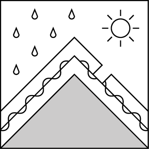
Cloud cover and above freezing air temperatures in many locations last night are expected to have allowed for a poor to at best decent overnight snow surface refreeze. The amount of refreeze could vary significantly from one location to another around the forecast area this morning. Cloud cover and wind this morning may slow the rate of surface wet snow formation. Sunny skies and well above freezing air temperatures by this afternoon are expected to allow for loose wet avalanche problems to form on all aspects today. In areas with little to no refreeze last night this avalanche problem will exist this morning. In any areas where a decent refreeze occurred, this avalanche problem may hold off until the late morning or early afternoon hours.

Avoid travel in avalanche terrain once wet surface snow begins to loose supportability.

Avalanche Problem 2: Wet Slab
  • Type ?
  • Aspect/Elevation ?
  • Likelihood ?
    Certain
    Very Likely
    Likely
    Possible
    Unlikely
  • Size ?
    Historic
    Very Large
    Large
    Small

Wet slab avalanche problems are unlikely, but not impossible today. The areas most conducive to wet slab avalanches are in near treeline or above treeline terrain on SE-E aspects where the best mix of past wind loading and current snowpack warming overlap. In these areas recent storm snow exists below the surface melt freeze snow and is receiving melt water percolation during daytime melt.

Avoid travel in avalanche terrain once wet surface snow begins to loose supportability.

recent observations

Observations made yesterday morning on Incline Lake Peak (Mount Rose area) revealed a good overnight refreeze on E-SE-S-SW aspects but just a thin breakable crust on N-NE aspects. Signs of loose wet instability existed at 9,500' on a NE aspect along the summit ridge at 9:50 am.

A report was received of a skier triggered wet slab avalanche occurring around noon in the Rose Knob/Third Creek Drainage (Mount Rose area). The avalanche occurred on a SE aspect around 8,500'. The avalanche failed about 1 foot deep and 60 feet wide. The avalanche was triggered by the fourth skier on the slope. The snowpack was reported by the party to have failed in recent storm snow below the surface layer of melt-freeze snow. Two snowpack collapses were noted by the party. One when the avalanche initiated and a seconded while the debris were moving down slope. The party reported that the snow surface had begun to loose supportability in the area prior to the avalanche occurrence.

Weather and CURRENT CONDITIONS
weather summary

Weather systems continue to pass to the north of the forecast area bringing wind and periods of cloud cover. Cloudy skies this morning are expected to clear by this afternoon before becoming cloudy again overnight. Very light precipitation is expected tomorrow. Ridgetop winds remain moderate to strong in speed out of the SW. Wind speeds are forecast to decrease a bit this afternoon and tonight before increasing again tomorrow. Maximum daytime air temperatures above 7,000' are on a cooling trend today and tomorrow, but are still expected to reach above freezing.


CONDITIONS ALONG THE SIERRA CREST BETWEEN 8200 FT. AND 9200 FT. IN THE LAST 24 HOURS
6am temperature: 32 to 38 deg. F.
Max. temperature: 43 to 52 deg. F.
Average ridgetop wind direction: SW
Average ridgetop wind speed: 51 mph
Maximum ridgetop wind gust: 79 mph
New snowfall: 0 inches
Total snow depth: 122 to 189 inches
Two-Day Mountain Weather Forecast Produced in partnership with the Reno NWS
For 7000 ft. to 8000 ft.
Sunday Sunday Night Monday
Weather: Mostly cloudy skies, becoming sunny. Partly cloudy skies, becoming mostly cloudy. Cloudy skies, becoming mostly cloudy. Scattered snow showers in the morning. Isolated rain showers in the afternoon.
Temperatures: 46 to 54 deg. F. 30 to 35 deg. F. 38 to 43 deg. F.
Mid Slope Winds: SW SW SW
Wind Speed: 10 to 20 mph with gusts up to 35 mph. 10 to 15 mph with gusts to 35 mph in the evening, becoming light. 10 to 15 mph increasing to 20 to 30 mph in the afternoon. Gusts to 60 mph.
Expected snowfall: 0 0 Up to 1
For 8000 ft. to 9000 ft.
Sunday Sunday Night Monday
Weather: Mostly cloudy skies, becoming sunny. Partly cloudy skies, becoming mostly cloudy. Cloudy skies, becoming mostly cloudy. Scattered snow showers in the morning. Isolated snow showers in the afternoon.
Temperatures: 38 to 46 deg. F. 28 to 33 deg. F. 34 to 40 deg. F.
Ridge Top Winds: SW SW W
Wind Speed: 30 to 45 mph with gusts to 65 mph, decreasing to 20 to 35 mph with gusts to 45 mph in the afternoon. 20 to 30 mph with gusts to 55 mph. 30 to 50 mph with gusts to 85 mph.
Expected snowfall: 0 0 Up to 2
Disclaimer

This avalanche advisory is provided through a partnership between the Tahoe National Forest and the Sierra Avalanche Center. This advisory covers the Central Sierra Nevada Mountains between Yuba Pass on the north and Ebbetts Pass on the south. Click here for a map of the forecast area. This advisory applies only to backcountry areas outside established ski area boundaries. This advisory describes general avalanche conditions and local variations always occur. This advisory expires 24 hours after the posted time unless otherwise noted. The information in this advisory is provided by the USDA Forest Service who is solely responsible for its content.

For a recorded version of the Avalanche Advisory call (530) 587-3558 x258