In partnership with: 
| Date and time of observation or avalanche occurrence | Location | Media | Observation made by |
|---|---|---|---|
|
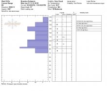
02/03/2018 - 13:30 Snowpack Observation |
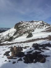
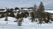
Underwood Bowl Bear Valley Area |
     |
Forecaster |
|
02/03/2018 - 12:00 Snowpack Observation |
Red Lake Peak SW Carson Pass Area |
   |
Forecaster |
|
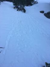
02/02/2018 - 12:30 Snowpack Observation |
Fireplug Mount Rose Area |
 |
Forecaster |
|
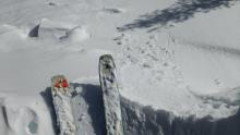
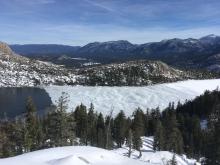
02/02/2018 - 12:15 Snowpack Observation |
N. Ridge of Silver Peak Cabin Creek, Deep Creek, or Pole Creek Area |
   |
Educator Tahoe Mountain Scho |
|
02/02/2018 - 10:15 Snowpack Observation |
Lincoln Valley Yuba Pass Area |
  |
Forecaster |
|
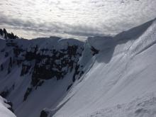
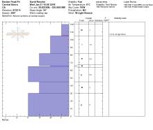
02/01/2018 - 13:30 Snowpack Observation |
Crest above Pole Creek Donner Summit Area |
   |
Guide Tahoe Mountain Scho |
|
02/01/2018 - 00:00 Snowpack Observation |
Mt. Lola/Upper Cold Stream Independence Lake Area |
   |
Forecaster |
|
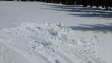
01/31/2018 - 13:00 Snowpack Observation |
Castle Peak Donner Summit Area |
 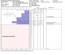 |
Forecaster |
|
01/31/2018 - 11:00 Snowpack Observation |
Slab Cliffs Mount Rose Area |
  |
Forecaster |
|
01/31/2018 - 10:00 Snowpack Observation |
Becker Peak Echo Summit Area |
    |
Professional Observer |
|
01/30/2018 - 13:00 Snowpack Observation |
Lake of the Woods Independence Lake Area |
  |
Forecaster |
|
01/29/2018 - 13:45 Snowpack Observation |
Elephant's Hump Carson Pass Area |
|
Forecaster |
|
01/29/2018 - 13:10 Snowpack Observation |
National Geographic Bowl, Granite Chief Cabin Creek, Deep Creek, or Pole Creek Area |
 |
Guide Alpenglow Expeditio |
|
01/29/2018 - 13:00 Snowpack Observation |
North Castle Peak Donner Summit Area |
   |
Public |
|
01/29/2018 - 11:45 Snowpack Observation |
Ophir Peak Mount Rose Area |
   |
Forecaster |


This website is owned and maintained by the non-profit arm of the Sierra Avalanche Center. Some of the content is updated by the USDA avalanche forecasters including the forecasts and some observational data. The USDA is not responsible for any advertising, fund-raising events/information, or sponsorship information, or other content not related to the forecasts and the data pertaining to the forecasts.


