In partnership with: 
| Date and time of observation or avalanche occurrence | Location | Media | Observation made by |
|---|---|---|---|
|
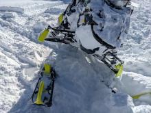
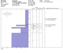
12/15/2021 - 12:00 Snowpack Observation |
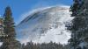
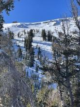
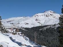
Border Ruffian Carson Pass Area |
|
Professional Observer |
|
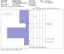
12/14/2021 - 13:30 Snowpack Observation |
Waterhouse Peak Luther Pass Area (including Job and Freel) |
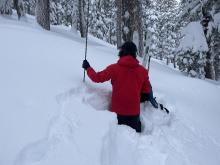      |
Professional Observer |
|
12/14/2021 - 12:30 Snowpack Observation |
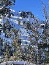
Andesite Peak Donner Summit Area |
    |
Forecaster |
|
12/14/2021 - 11:15 Snowpack Observation |
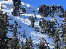
Johnson Canyon Donner Summit Area |
Educator West Wind Collecti |
|
|
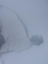
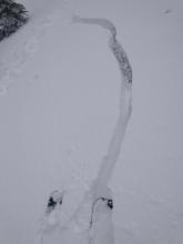
12/14/2021 - 01:01 Avalanche Observation |
Relay Ridgeline Mount Rose Area |
  |
Public |
|
12/13/2021 - 15:35 Snowpack Observation |
Mt. Rose Highway Mount Rose Area |
 |
Public |
|
12/13/2021 - 12:00 Snowpack Observation |
Pickett Peak Woodfords Canyon |
|
Professional Observer |
|
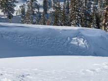
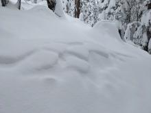
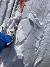
12/13/2021 - 11:10 Avalanche Observation |
Far East Ridge of Tamarack Peak Mount Rose Area |
 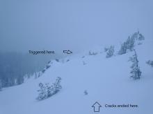       |
Forecaster |
|
12/13/2021 - 10:00 Avalanche Observation |
Far East Ridge of Tamarack Peak Mount Rose Area |
|
Forecaster |
|
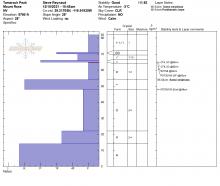
12/12/2021 - 11:30 Snowpack Observation |
Lincoln Ridge Yuba Pass Area |
    |
Forecaster |
|
12/11/2021 - 11:00 Snowpack Observation |
Castle Peak Donner Summit Area |
     |
Forecaster |
|
12/11/2021 - 08:10 Avalanche Observation |
Base of Elephants Back Carson Pass Area |
 |
Public |
|
12/10/2021 - 11:03 Avalanche Observation |
Tamarack Peak Mount Rose Area |
   |
Guide Blackbird Mountain Guid |
|
12/10/2021 - 11:00 Snowpack Observation |
Black Butte Carson Pass Area |
      |
Professional Observer |
|
12/10/2021 - 11:00 Snowpack Observation |
Tamarack Peak Mount Rose Area |
    |
Forecaster |


This website is owned and maintained by the non-profit arm of the Sierra Avalanche Center. Some of the content is updated by the USDA avalanche forecasters including the forecasts and some observational data. The USDA is not responsible for any advertising, fund-raising events/information, or sponsorship information, or other content not related to the forecasts and the data pertaining to the forecasts.