


For 7000 ft. to 8000 ft.
| Friday | Friday Night | Saturday | |
|---|---|---|---|
| Weather: | Partly cloudy becoming cloudy with a chance of rain showers especially in the afternoon and a slight chance of thunderstorms. Snow level 9500 ft. to 10000 ft. | Cloudy with a slight chance of thunderstorms in the evening and widespread rain showers through the night. Snow level above 9000 ft. | Cloudy with showers likely in the morning and a slight chance of thunderstorms in the afternoon. Snow level dropping to around 8000 ft. by the afternoon. |
| Temperatures: | 50 to 57 deg. F. | 28 to 35 deg. F. | 39 to 46 deg. F. |
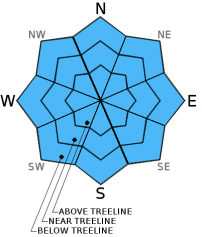
| Mid Slope Winds: | East | South | Southwest |
| Wind Speed: | Light | Light | Light |
| Expected snowfall: | Rain: 0 to .1 | Rain: .1 to .3 | Rain: .2 to .4 inches | Above snow level, snow: up to 2 |
For 8000 ft. to 9000 ft.
| Friday | Friday Night | Saturday | |
|---|---|---|---|
| Weather: | Partly cloudy becoming cloudy with a chance of rain showers especially in the afternoon and a slight chance of thunderstorms. Snow level 9500 ft. to 10000 ft. | Cloudy with a slight chance of thunderstorms in the evening and widespread rain showers through the night. Snow level above 9000 ft. | Cloudy with showers likely in the morning and a slight chance of thunderstorms in the afternoon. Snow level dropping to around 8000 ft. by the afternoon. |
| Temperatures: | 49 to 55 deg. F. | 26 to 33 deg. F. | 35 to 42 deg. F. |
| Ridge Top Winds: | East | South | Southwest |
| Wind Speed: | 15 to 25 mph with gusts to 40 mph decreasing to 30 mph in the afternoon | 15 to 20 mph with gusts to 30 mph | 10 to 15 mph |
| Expected snowfall: | Rain: 0 to .1 inches | Above snow level, snow: up to 1 | Rain: .1 to .3 inches | Above snow level, snow: up to 3 | Rain: .2 to .4 inches | Above snow level, snow: up to 4 |


