


For 7000 ft. to 8000 ft.
| Friday | Friday Night | Saturday | |
|---|---|---|---|
| Weather: | Partly cloudy with periods of full sun | Partly cloudy becoming mostly cloudy with a slight chance of rain and a chance of rain and snow after midnight. Precipitation chances are mainly north of I-80 | Partly cloudy becoming mostly cloudy |
| Temperatures: | 49 to 56 deg. F. | 30 to 35 deg. F. | 43 to 50 deg. F. |
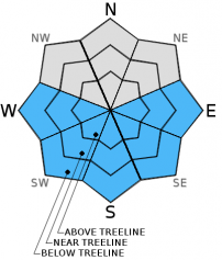
| Mid Slope Winds: | Southwest | Southwest | Southwest |
| Wind Speed: | 10 to 15 mph increasing to 15 to 25 mph with gusts to 35 mph in the afternoon | 15 to 25 mph with gusts to 40 mph increasing to 20 to 30 mph with gusts to 50 mph after midnight | 10 to 20 mph with gusts to 30 mph |
| Expected snowfall: | 0 | trace to 0 | 0 |
For 8000 ft. to 9000 ft.
| Friday | Friday Night | Saturday | |
|---|---|---|---|
| Weather: | Partly cloudy with periods of full sun | Partly cloudy becoming mostly cloudy with a slight chance of rain and snow and a chance of snow after midnight. Precipitation chances are mainly north of I-80 | Partly cloudy becoming mostly cloudy |
| Temperatures: | 41 to 49 deg. F. | 25 to 30 deg. F. | 35 to 43 deg. F. |
| Ridge Top Winds: | Southwest | Southwest | Southwest |
| Wind Speed: | 20 to 30 mph increasing to 30 to 40 mph with gusts to 60 mph in the afternoon | 35 to 50 mph with gusts to 75 mph | 20 to 30 mph with gusts to 50 mph decreasing to 40 mph in the afternoon |
| Expected snowfall: | 0 | less than 1 | 0 |


