THIS AVALANCHE FORECAST EXPIRED ON January 18, 2016 @ 7:01 am
Avalanche Forecast published on January 17, 2016 @ 7:01 am
Issued by Brandon Schwartz - Tahoe National Forest

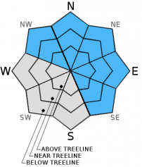
MODERATE avalanche danger continues at all elevations on NW-N-NE-E-SE aspects on slopes 32 degrees and steeper due to a combination of persistent slabs and storm slabs. Human triggered avalanches remain a near daily occurrence within the forecast area. Identify the necessary differences between managing wind slab and persistent slab avalanche problems and adjust terrain selection and travel practices accordingly. Increasing avalanche danger is expected tonight into tomorrow morning.

2. Moderate

?

Above Treeline
Heightened avalanche conditions on specific terrain features. Evaluate snow and terrain carefully; identify features of concern.

2. Moderate

?

Near Treeline
Heightened avalanche conditions on specific terrain features. Evaluate snow and terrain carefully; identify features of concern.

2. Moderate

?

Below Treeline
Heightened avalanche conditions on specific terrain features. Evaluate snow and terrain carefully; identify features of concern.
    Heightened avalanche conditions on specific terrain features. Evaluate snow and terrain carefully; identify features of concern.
Avalanche Problem 1: Persistent Slab
  • Type ?
  • Aspect/Elevation ?
  • Likelihood ?
    Certain
    Very Likely
    Likely
    Possible
    Unlikely
  • Size ?
    Historic
    Very Large
    Large
    Small

Unintentional human triggered avalanche activity continues to be a near daily occurrence in areas where persistent slabs exist. Yesterday's reported avalanche activity occurred on Andesite Ridge (Donner Summit area)(more info below in recent observations). Buried surface hoar is a persistent weak layer that remains unstable for prolonged periods of time. Open areas near treeline and below treeline on N-NE-E aspects hold the greatest concentration of buried surface hoar with 1 to 3 layers buried 2 to 3 feet deep. NW and SE aspects near treeline and below treeline hold isolated areas of buried surface hoar.

There are 8 different types of avalanche problems. Wind slabs are the common avalanche problem in the Sierra. Instability usually last for hours to days and wind slab location is very predictable. Persistent slabs focused on buried surface hoar layers are an entirely different problem with very different characteristics and predictability in terms of location and length of unstable time period. Travel in the backcountry requires a different approach when managing persistent slabs as opposed to managing wind slabs. With persistent slabs, anticipate the potential to trigger avalanches low on slopes, after slopes have been traveled by others, and in lower angle terrain in the 30 to 35 degree slope angle range. Communicate with your partners and adjust terrain selection and travel practices in accordance with the avalanche problem, not just based on the overall danger rating.

Avalanche Problem 2: Wind Slab
  • Type ?
  • Aspect/Elevation ?
  • Likelihood ?
    Certain
    Very Likely
    Likely
    Possible
    Unlikely
  • Size ?
    Historic
    Very Large
    Large
    Small

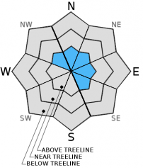
A new round of wind slab formation will begin to occur late today following the onset of snowfall. Above treeline areas will be the first affected with wind slabs forming on top loaded N-NE-E aspects and cross loaded NW and SE aspects. These wind slabs will increase in size tonight and tomorrow morning, becoming large enough to bury or injure a person.

recent observations

A report was received of an avalanche incident yesterday on Andesite Ridge (Donner Summit area) where two individuals were involved in an avalanche on a NE aspect slope near treeline around 7,600'. One individual escaped off the side of the slab while the other was able to grab a tree. Multiple layers of buried surface hoar are known to exist in this area.

Observations made and received yesterday from Donner Peak (Donner Pass area), Becker Ridge (Echo Summit area),Waterhouse Peak (Luther Pass area), and from the Bear Valley area all indicated that rain had occurred as high as 8,000' to 8,500'. In some areas rain changed to either mixed precipitation or graupel with up to an inch of accumulation.

Skier triggered collapses were observed yesterday in the Donner Peak area. In some cases the areas where collapse was observed had already be traveled by 7 to 10 people. Continued unstable snowpit test results were noted in the Donner Peak and Waterhouse Peak areas. Obvious instability remains in the Andesite Ridge area, with some parties reporting mix results from snowpit data in this area - A direct indication that where snowpits are placed matters greatly.

Second and third hand accounts of avalanche accidents not reported to the avalanche center continue to reach the ears of the forecasters. Please submit your observations so that facts and rumors remain separate. Without the documented facts, we must treat these reports as rumors. What we must classify as rumors we do not post in an effort to avoid spreading misinformation.

Weather and CURRENT CONDITIONS
weather summary

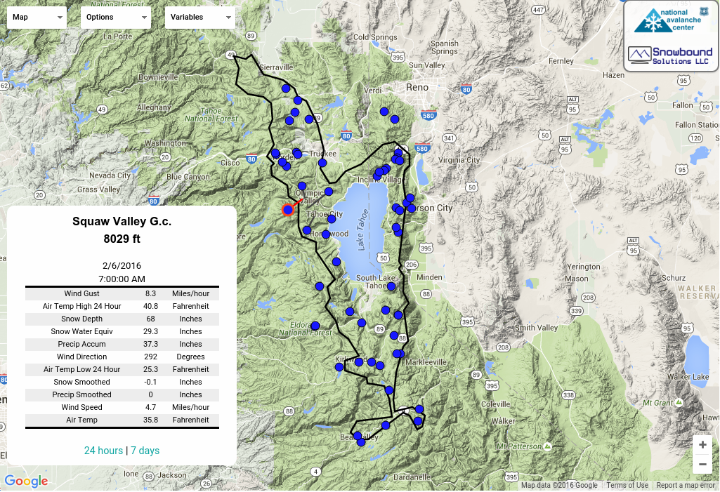
The next storm system is approaching the forecast area. Increasing cloud cover and increasing ridgetop winds are expected today. Light snow showers are possible this afternoon over the far northern portion of the forecast area. Snowfall will spread to the rest of the forecast area this evening and tonight. Snow levels are forecast for around 6,500' today and will lower a bit tonight. New snow amounts over the next 30 hours are forecast at 6 to 12 inches for most areas above 7,000' with a few locations of 8 to 14 inches possible along the Sierra Crest. Maximum daytime air temperatures will be near to above freezing for most areas today. Temperatures for tomorrow are expected to be around 5 to  10 degrees colder following cold front passage tonight.

CONDITIONS ALONG THE SIERRA CREST BETWEEN 8200 FT. AND 9200 FT. IN THE LAST 24 HOURS
6am temperature: 23 to 33 deg. F.
Max. temperature: 32 to 36 deg. F.
Average ridgetop wind direction: SW
Average ridgetop wind speed: 30 mph
Maximum ridgetop wind gust: 67 mph
New snowfall: 0 to 1 inches
Total snow depth: 54 to 63 inches
Two-Day Mountain Weather Forecast Produced in partnership with the Reno NWS
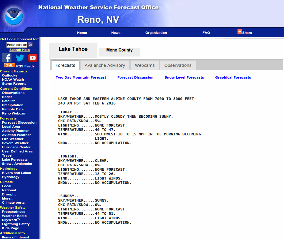
For 7000 ft. to 8000 ft.
Sunday Sunday Night Monday
Weather: Mostly cloudy skies, becoming cloudy. A chance of snow in the afternoon. Cloudy skies with snow. Cloudy skies, becoming mostly cloudy. Snow in the morning. Snow showers likely in the afternoon.
Temperatures: 34 to 41 deg. F. 25 to 30 deg. F. 29 to 34 deg. F.
Mid Slope Winds: SW SW SW
Wind Speed: 15 to 30 mph with gusts to 40 mph, increasing to 30 to 40 mph with gusts to 70 mph in the afternoon. 30 to 45 with gusts to 70 mph, decreasing to 20 to 35 mph with gust to 55 mph after midnight. 20 to 30 mph with gusts to 40 mph, decreasing to 10 to 20 mph with gusts to 30 mph in the afternoon.
Expected snowfall: Trace 4 to 8 2 to 5
For 8000 ft. to 9000 ft.
Sunday Sunday Night Monday
Weather: Mostly cloudy skies, becoming cloudy. A chance of snow in the afternoon. Cloudy skies with snow. Cloudy skies, becoming mostly cloudy. Snow in the morning. Snow showers likely in the afternoon.
Temperatures: 29 to 34 deg. F. 21 to 27 deg. F. 24 to 29 deg. F.
Ridge Top Winds: SW SW SW
Wind Speed: 35 to 45 mph with gusts to 65 mph, increasing to 50 to 60 mph with gusts to 90 mph in the afternoon. 55 to 65 mph with gusts to 95 mph, decreasing to 45 to 55 mph with gusts to 85 mph after midnight. 35 to 45 mph with gusts to 65 mph, decreasing to 10 to 20 mph with gusts to 40 mph in the afternoon.
Expected snowfall: Trace 4 to 8 2 to 5
Disclaimer

This avalanche advisory is provided through a partnership between the Tahoe National Forest and the Sierra Avalanche Center. This advisory covers the Central Sierra Nevada Mountains between Yuba Pass on the north and Ebbetts Pass on the south. Click here for a map of the forecast area. This advisory applies only to backcountry areas outside established ski area boundaries. This advisory describes general avalanche conditions and local variations always occur. This advisory expires 24 hours after the posted time unless otherwise noted. The information in this advisory is provided by the USDA Forest Service who is solely responsible for its content.