


For 7000 ft. to 8000 ft.
| Tuesday | Tuesday Night | Wednesday | |
|---|---|---|---|
| Weather: | Mostly cloudy then becoming partly cloudy. | Partly cloudy. | Partly cloudy. |
| Temperatures: | 50 to 58 deg. F. | 31 to 37 deg. F. | 51 to 59 deg. F. |
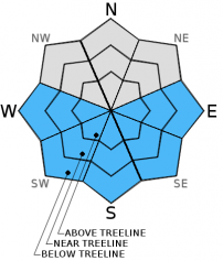
| Mid Slope Winds: | SW | SW | SW |
| Wind Speed: | 15 to 20mph with gusts to 30mph increasing to 25 to 30mph with gusts to 45mph in the afternoon. | 20 to 30mph with gusts to 45mph decreasing to 35mph after midnight. | 10 to 15mph with gusts to 25mph increasing to 20 to 25mph with gusts to 40mph in the afternoon. |
| Expected snowfall: | 0 | 0 | 0 |
For 8000 ft. to 9000 ft.
| Tuesday | Tuesday Night | Wednesday | |
|---|---|---|---|
| Weather: | Partly cloudy. | Partly cloudy. | Partly cloudy. |
| Temperatures: | 45 to 51 deg. F. | 26 to 33 deg. F. | 46 to 52 deg. F. |
| Ridge Top Winds: | SW | SW | SW |
| Wind Speed: | 30 to 35mph with gusts to 50mph increasing to 45 to 50mph with gusts to 80mph in the afternoon. | 50 to 55mph with gusts to 80mph decreasing to 30 to 35mph with gusts to 55mph after midnight. | 30 to 35mph with gusts to 50mph increasing to 40 to 45mph with gusts to 70mph in the afternoon. |
| Expected snowfall: | 0 | 0 | 0 |


