The last avalanche forecast for the 2023-2024 season posted on April 21st. Thank you to all who contributed to the avalanche center this season through observations, volunteer time, and/or financial contributions.
In partnership with: 
The last avalanche forecast for the 2023-2024 season posted on April 21st. Thank you to all who contributed to the avalanche center this season through observations, volunteer time, and/or financial contributions.
| Date and time of observation or avalanche occurrence | Location | Media | Observation made by |
|---|---|---|---|
|
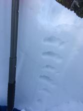
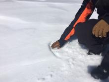
02/02/2020 - 05:00 Snowpack Observation |
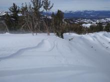
White Rock Lake Outside of the Forecast Area |
 |
Public |
|
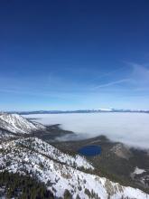
02/01/2020 - 14:15 Snowpack Observation |
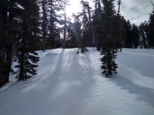
Mt. Lola Independence Lake Area |
 |
Public |
|
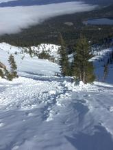
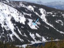
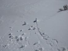
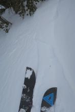
02/01/2020 - 13:00 Avalanche Observation |
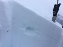
Near Bear meadow Independence Lake Area |
    |
Public |
|
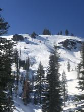
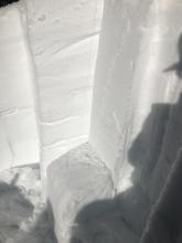
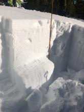
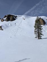
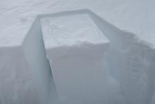
02/01/2020 - 12:30 Snowpack Observation |
Johnson Canyon Donner Summit Area |
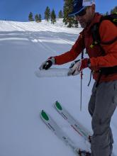     |
Forecaster |
|
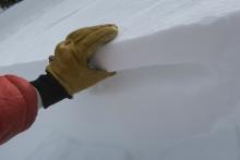
02/01/2020 - 12:00 Snowpack Observation |
Meiss headwaters Carson Pass Area |
   |
Professional Observer |
|
01/31/2020 - 12:15 Snowpack Observation |
Tallac Desolation Wilderness Area (including Emerald Bay) |
     |
Professional Observer |
|
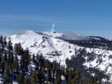
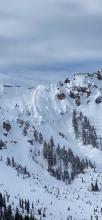
01/31/2020 - 11:00 Avalanche Observation |
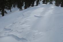
Red Lake Peak Carson Pass Area |
 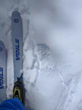 
|
Forecaster |
|
01/30/2020 - 15:00 Avalanche Observation |
Donner Pass Donner Summit Area |
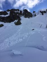 |
Guide Tahoe Mountain Scho |
|
01/30/2020 - 13:30 Avalanche Observation |
Desolation wilderness Desolation Wilderness Area (including Emerald Bay) |
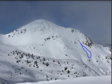 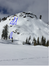 |
Guide Alpine Skills International (AS |
|
01/30/2020 - 12:30 Snowpack Observation |
Carpenter Ridge Independence Lake Area |
    |
Forecaster |
|
01/29/2020 - 11:00 Snowpack Observation |
Tamarack Peak Mount Rose Area |
      |
Public |
|
01/29/2020 - 11:00 Snowpack Observation |
Incline Peak/Slab Cliffs Mount Rose Area |
     |
Forecaster |
|
01/29/2020 - 11:00 Snowpack Observation |
Trimmer Peak Luther Pass Area (including Job and Freel) |
    |
Professional Observer |
|
01/29/2020 - 01:30 Avalanche Observation |
North Side Castle Peak Donner Summit Area |
 |
Public |
|
01/28/2020 - 11:00 Snowpack Observation |
Hidden Peak West Shore Area |
    |
Forecaster |


This website is owned and maintained by the non-profit arm of the Sierra Avalanche Center. Some of the content is updated by the USDA avalanche forecasters including the forecasts and some observational data. The USDA is not responsible for any advertising, fund-raising events/information, or sponsorship information, or other content not related to the forecasts and the data pertaining to the forecasts.