The last avalanche forecast for the 2023-2024 season posted on April 21st. Thank you to all who contributed to the avalanche center this season through observations, volunteer time, and/or financial contributions.
In partnership with: 
The last avalanche forecast for the 2023-2024 season posted on April 21st. Thank you to all who contributed to the avalanche center this season through observations, volunteer time, and/or financial contributions.
| Date and time of observation or avalanche occurrence | Location | Media | Observation made by |
|---|---|---|---|
|
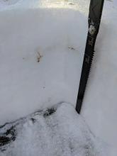
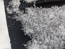
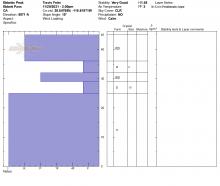
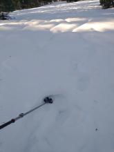
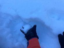
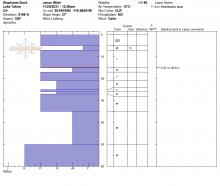
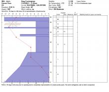
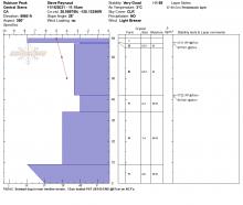
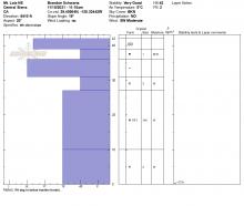
12/02/2021 - 11:00 Snowpack Observation |
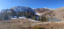
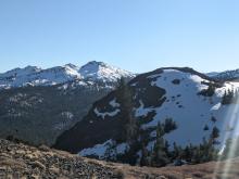
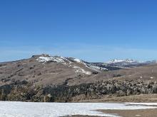
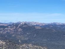
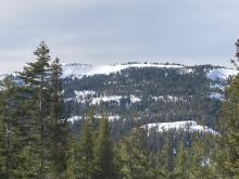
Lincoln Ridge Yuba Pass Area |
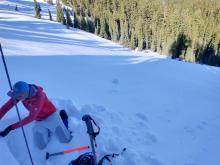   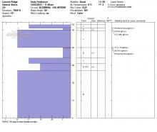 |
Forecaster |
|
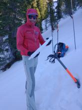
12/01/2021 - 12:00 Snowpack Observation |
Relay Peak Mount Rose Area |
|
Forecaster |
|
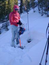
12/01/2021 - 11:00 Snowpack Observation |
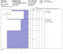
Red Lake Peak Carson Pass Area |
   |
Professional Observer |
|
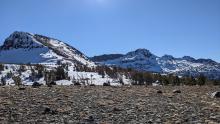
11/30/2021 - 11:45 Snowpack Observation |
Mount Lola Independence Lake Area |
     |
Forecaster |
|
11/29/2021 - 14:00 Snowpack Observation |
Ebbetts Peak Ebbetts Pass Area |
     |
Professional Observer |
|
11/29/2021 - 11:30 Snowpack Observation |
Castle Peak Donner Summit Area |
      |
Forecaster |
|
11/28/2021 - 13:00 Snowpack Observation |
Elephants Back Carson Pass Area |
       |
Professional Observer |
|
11/24/2021 - 11:00 Snowpack Observation |
Tamarack Peak Mount Rose Area |
   |
Forecaster |
|
11/24/2021 - 08:33 Snowpack Observation |
Silver Peak Cabin Creek, Deep Creek, or Pole Creek Area |
   |
Public |
|
11/23/2021 - 11:50 Snowpack Observation |
Kirkwood - Sentinel Bowl Carson Pass Area |
  |
Public |
|
11/22/2021 - 12:00 Snowpack Observation |
Elephants Back Area Carson Pass Area |
     |
Forecaster |
|
11/19/2021 - 16:25 Snowpack Observation |
Noble canyon trailhead Ebbetts Pass Area |
  |
Public |
|
11/19/2021 - 11:00 Snowpack Observation |
Tamarack Peak Mount Rose Area |
    |
Forecaster |
|
11/16/2021 - 23:15 Snowpack Observation |
Rubicon Peak West Shore Area |
       |
Forecaster |
|
11/15/2021 - 23:15 Snowpack Observation |
Mt. Lola - NE Ridge Independence Lake Area |
    |
Forecaster |


This website is owned and maintained by the non-profit arm of the Sierra Avalanche Center. Some of the content is updated by the USDA avalanche forecasters including the forecasts and some observational data. The USDA is not responsible for any advertising, fund-raising events/information, or sponsorship information, or other content not related to the forecasts and the data pertaining to the forecasts.