In partnership with: 
| Date and time of observation or avalanche occurrence | Location | Media | Observation made by |
|---|---|---|---|
|
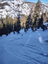
01/24/2022 - 16:34 Snowpack Observation |
Tamarack Peak Mount Rose Area |
Public | |
|
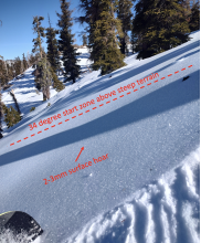
01/24/2022 - 11:00 Snowpack Observation |
Relay Peak Mount Rose Area |
   |
Forecaster |
|
01/24/2022 - 10:44 Snowpack Observation |
Red Lake peak Carson Pass Area |
     |
Professional Observer |
|
01/23/2022 - 23:30 Snowpack Observation |
1mile N of Mt Lola Little Truckee Summit Areas |
       |
Public |
|
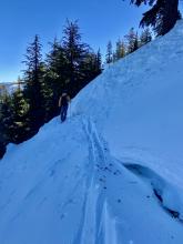
01/23/2022 - 12:36 Snowpack Observation |
Castle Peak North Bowl Donner Summit Area |
    |
Public |
|
01/23/2022 - 12:11 Snowpack Observation |
Castle Peak Donner Summit Area |
    |
Educator West Wind Collecti |
|
01/23/2022 - 12:07 Snowpack Observation |
Tamarack Ebbetts Pass Area |
  |
Public |
|
01/23/2022 - 11:34 Snowpack Observation |
Tamarak lake Carson Pass Area |
Public | |
|
01/23/2022 - 11:00 Snowpack Observation |
Castle Peak / Coon Canyon Donner Summit Area |
Public | |
|
01/23/2022 - 11:00 Snowpack Observation |
Castle Peak, Ridge above Coon Canyon Donner Summit Area |
 |
Public |
|
01/22/2022 - 13:26 Snowpack Observation |
Luther Pass Luther Pass Area (including Job and Freel) |
         |
Professional Observer |
|
01/22/2022 - 13:00 Snowpack Observation |
Waterhouse North Luther Pass Area (including Job and Freel) |
    |
Public |
|
01/22/2022 - 12:30 Snowpack Observation |
Castle Peak Donner Summit Area |
   |
Educator West Wind Collecti |
|
01/22/2022 - 12:00 Snowpack Observation |
Ebbetts Pass Ebbetts Pass Area |
 |
Public |
|
01/22/2022 - 10:00 Snowpack Observation |
Stoney Ridge West Shore Area |
       |
Forecaster |


This website is owned and maintained by the non-profit arm of the Sierra Avalanche Center. Some of the content is updated by the USDA avalanche forecasters including the forecasts and some observational data. The USDA is not responsible for any advertising, fund-raising events/information, or sponsorship information, or other content not related to the forecasts and the data pertaining to the forecasts.

