In partnership with: 
| Date and time of observation or avalanche occurrence | Location | Media | Observation made by |
|---|---|---|---|
|
12/29/2022 - 11:00 Snowpack Observation |
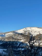
Tamarack Mount Rose Area |
Public | |
|
12/29/2022 - 11:00 Avalanche Observation |
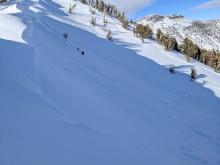
Lincoln Ridge Yuba Pass Area |
       |
Forecaster |
|
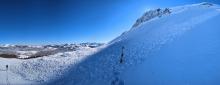
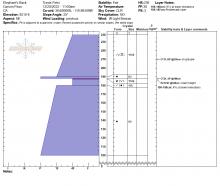
12/28/2022 - 15:15 Snowpack Observation |
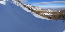
Castle Peak S aspect @ 8,200' Donner Summit Area |
   |
Guide Blackbird Mountain Guid |
|
12/28/2022 - 14:00 Snowpack Observation |
Rubicon West Shore Area |
 |
Guide Tahoe Mountain Scho |
|
12/28/2022 - 13:00 Snowpack Observation |
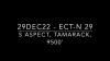
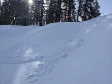
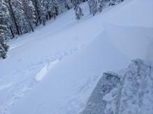
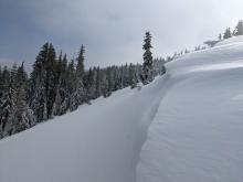
Tamarack Peak Mount Rose Area |
      |
Forecaster |
|
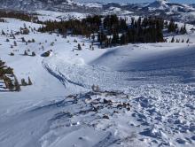
12/28/2022 - 11:55 Avalanche Observation |
Hidden Peak Desolation Wilderness Area (including Emerald Bay) |
  |
Public |
|
12/28/2022 - 11:30 Snowpack Observation |
Andesite Peak Donner Summit Area |
  |
Guide International Alpine Guid |
|
12/28/2022 - 11:24 Snowpack Observation |
Talking Mountain Echo Summit Area |
       |
Professional Observer |
|
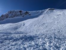
12/28/2022 - 11:01 Avalanche Observation |
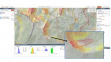
Castle Peak Donner Summit Area |
    |
Guide Tahoe Mountain Scho |
|
12/28/2022 - 10:00 Snowpack Observation |
Rubicon Peak West Shore Area |
Public | |
|
12/28/2022 - 09:56 Avalanche Observation |
Mt Rose Campground Mount Rose Area |
 |
Public |
|
12/28/2022 - 06:00 Avalanche Observation |
Elephant's Back Carson Pass Area |
     |
Professional Observer |
|
12/28/2022 - 05:00 Avalanche Observation |
Castle Peak Donner Summit Area |
   |
Forecaster |
|
12/27/2022 - 15:00 Avalanche Observation |
Tamarack Peak Mount Rose Area |
       |
Forecaster |
|
12/27/2022 - 12:00 Snowpack Observation |
Powderhouse Luther Pass Area (including Job and Freel) |
    |
Forecaster |


This website is owned and maintained by the non-profit arm of the Sierra Avalanche Center. Some of the content is updated by the USDA avalanche forecasters including the forecasts and some observational data. The USDA is not responsible for any advertising, fund-raising events/information, or sponsorship information, or other content not related to the forecasts and the data pertaining to the forecasts.